Mapping and Inspection

Map mines, quarries, forests, and other complex terrains with ease using the most sophisticated aerial terrain mapping features on the market. Guarantee perfect mapping results even in the most complex topographies by using custom terrain data to automate flight planning and execution.

Full coverage and careful terrain following guaranteed

Save operational costs by spending less time in the field.

Data Acquisition Solution for Inspection and Mapping

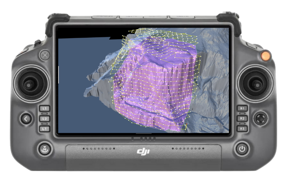
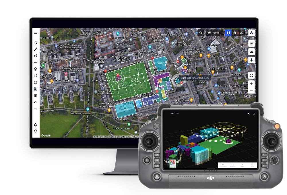
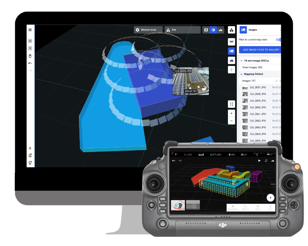
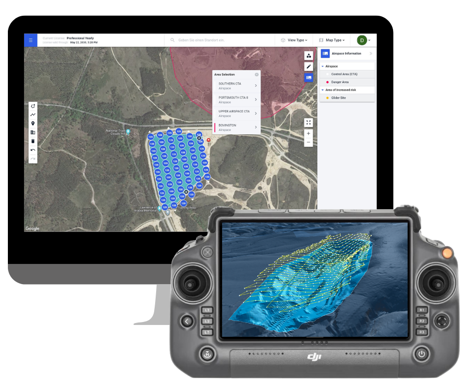
Drone Harmony’s Mapping & Inspection software is a holistic data capture solution for commercial mapping and inspection designed for professionals and enterprises that seek to maximize the productivity of their drone workflows. Drone Harmony features fully integrated 3D web and mobile applications that cover every aspect of data acquisition, from flight planning to flight automation and data review.

Plan Complex Missions with Ease

Access the most powerful 3D data capture software from any web browser or mobile device, supporting all common mapping and inspection use cases: Surveying, 2D Mapping, 3D Mapping, Mining, Construction, Industrial Inspection, Solar Inspection, Oil & Gas and more. Enjoy the richest feature set of automated tools, combined with flexibility of making arbitrary edits to flight missions in 2D and 3D. Enable seamless collaboration between planners, field teams and data engineers.

Fly and Gather Data with Confidence

Empower any field operator to become a drone pilot with safe, automated drone flights. Reduce the learning curve to a minimum and gain acceptance for your drone program from the field crews by proving them with a simple to use, safe and intuitive flight app.

Review Flights and Captured Data

Access all flight logs and image metadata files after the flight in the web app to organise and preview captured data. Overlay the image data on the Drone Harmony interface to gain initial insight into the state of the asset and plan additional captures accordingly. Synchronise flight logs automatically to your compliance software provider.

Faster visual inspections of industrial assets

Drone Harmony's 3D scene-based workflow provides an ultimate toolset for automating drone-based inspections of industrial assets such as buildings, silos, hangars, cranes, etc. Drone-based inspections represent a safer and more accurate alternative to traditional manual methods of visual inspection.

Skip the climbing through rough terrain - Work with Drone Harmony instead. Your benefits:

Input Your Custom Data

Base your plans on the most accurate terrain data available. Use custom, or in-app data to represent the terrain model for your project.

Get High Quality Data

Full coverage and careful terrain following are guaranteed by optimization algorithms - even in extreme topographies, such as cliffs and steep mountains.

Full Control

Adjust high-level parameters to achieve your exact mapping goals. Combine nadir and oblique images for better mapping of complex areas.

Scalable Solution

Flight plans can be shared and repeatedly flown. Train beginner pilots in less than 30 minutes.

Visualize Terrain in 3D

Plan and visualize both your terrain data and all flight plans in 3D in Drone Harmony Web.

Partners

Become a partner Learn more

Industries

Business intelligence derived from drone data is only as good as the data that is used to generate it.