Drone Harmony Integrates with Altitude Angel to Enhance Safety of Data Acquisition
December 1, 2020
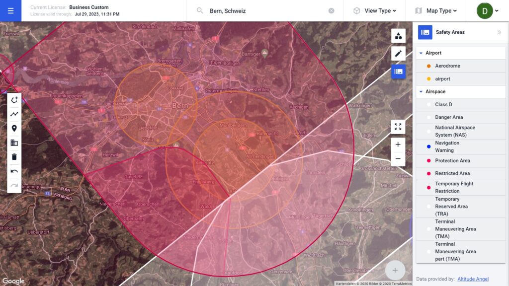
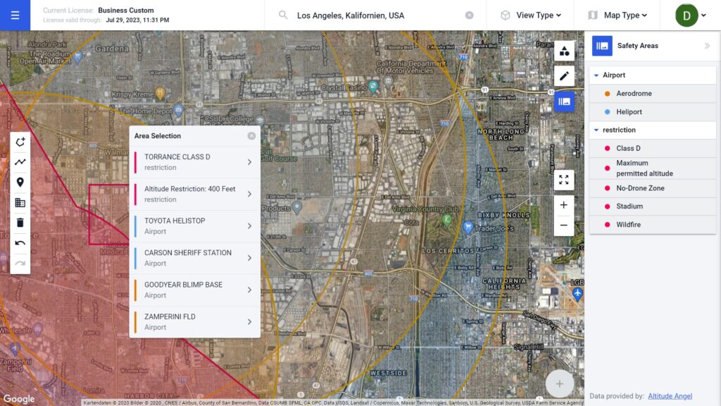
We have partnered with Altitude Angel, a leader in UTM (Unmanned Traffic Management) software, to provide Drone Harmony customers with in-app airspace information.
This integration underlines our commitment to ensure safer flight operation for our customers, as well as our commitment to constantly enrich our data capture platform with high-quality environment data.
Drone Harmony continues to enrich its data capture platform by integrating state of the art services. With the most recent integration, Drone Harmony customers can now view airspace data (airspace definitions, areas with flight restrictions, no fly zones, etc. ) provided by Altitude Angel within Drone Harmony Web.
Airspace overlays are presented in a distinct color and transparency scheme for easy distinction with other Drone Harmony primitives, such as areas and missions. The data is streamed directly from Altitude Angel and thus up-to-date with the Altitude Angel data pools.
This integration marks the beginning of our collaboration with Altitude Angel. In the future, Drone Harmony will strive to incorporate more types of data provided by Altitude Angel, relevant for flight planning and operations, such as airspace notification alerts, flight authorization capabilities (LAANC), Remote Identification (remoteID) and more.
Legislative Update On June 18, 2024, the House of Representatives passed the National Defense Authorization Act (NDAA), which includes the “Countering CCP Drones Act.” This bill aims to ban DJI drones by prohibiting their use of FCC communication infrastructure. However, the Senate Armed Services Committee (SASC) has recently released its marked-up version of the 2025...
We’re thrilled to announce a major update that combines all versions of our app into one streamlined platform, providing enhanced convenience and efficiency for both enterprise and professional users. Consolidation of Versions With this update, we have merged all versions of the app into a single comprehensive platform. This consolidation includes: Improved Accessibility Upon opening...
We are thrilled to announce a significant addition to our team. Adam Saciuk, with over twenty years of pioneering experience in industrial operational optimization, inspection, and drone program design, implementation, and execution, has joined Drone Harmony as the Chief Operations Officer for North America. This exciting development marks a pivotal moment in Drone Harmony’s journey...
March 2, 2024
Copyright 2024 Drone Harmony AG. All Rights Reserved.