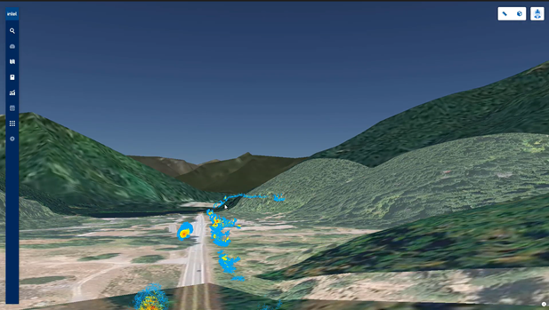
Drone Harmony has entered a partnership with Intel Geospatial, a newly released enterprise platform offering a unified platform for data management, visualization and analytics to unlock geospatial insights at scale. The partnership is designed to enable an improved experience for Intel customers needing reliable and scalable drone data acquisition.
Intel Geospatial – a unified platform for data management, visualization and analytics
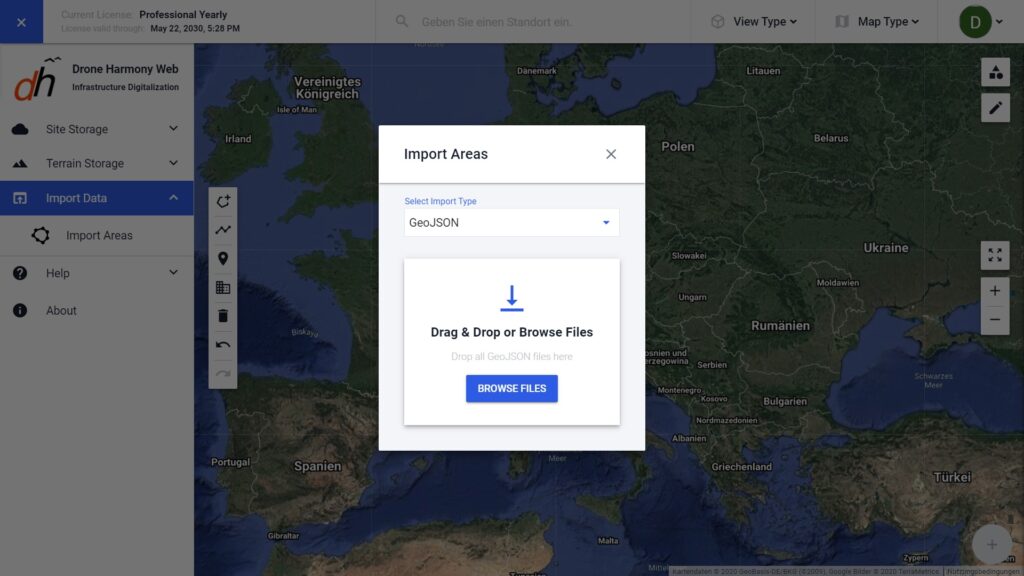
Drone Harmony Web can now import scene data exported from the Intel Geospatial system (in GeoJSON file format) for drone mission planning. All standard primitives are supported, including polygons, lines and points of interest. Furthermore, multiple files can be uploaded at once and GeoJSON properties are visible in the Drone Harmony Web interface after import.
Drone Harmony looks forward to a long-lasting collaboration with Intel Geospatial powering Intel’s enterprise customers in numerous industries, ranging from Electric Utilities to Oil & Gas using quality drone data.
Legislative Update On June 18, 2024, the House of Representatives passed the National Defense Authorization Act (NDAA), which includes the “Countering CCP Drones Act.” This bill aims to ban DJI drones by prohibiting their use of FCC communication infrastructure. However, the Senate Armed Services Committee (SASC) has recently released its marked-up version of the 2025...
We’re thrilled to announce a major update that combines all versions of our app into one streamlined platform, providing enhanced convenience and efficiency for both enterprise and professional users. Consolidation of Versions With this update, we have merged all versions of the app into a single comprehensive platform. This consolidation includes: Improved Accessibility Upon opening...
We are thrilled to announce a significant addition to our team. Adam Saciuk, with over twenty years of pioneering experience in industrial operational optimization, inspection, and drone program design, implementation, and execution, has joined Drone Harmony as the Chief Operations Officer for North America. This exciting development marks a pivotal moment in Drone Harmony’s journey...
March 2, 2024
Copyright 2024 Drone Harmony AG. All Rights Reserved.