Unveiling the Drone Harmony Image Gallery, UI Improvements, Floating Obstacles, and Speed Control Features
August 16, 2023
This blog post will explore the latest Drone Harmony enhancements, including the brand-new image gallery feature! Additional features include user interface improvements for large missions, floating obstacles, the ability to set speed on waypoints, and enhanced speed visualization. Let’s dive in and discover how these features can enhance your drone missions.
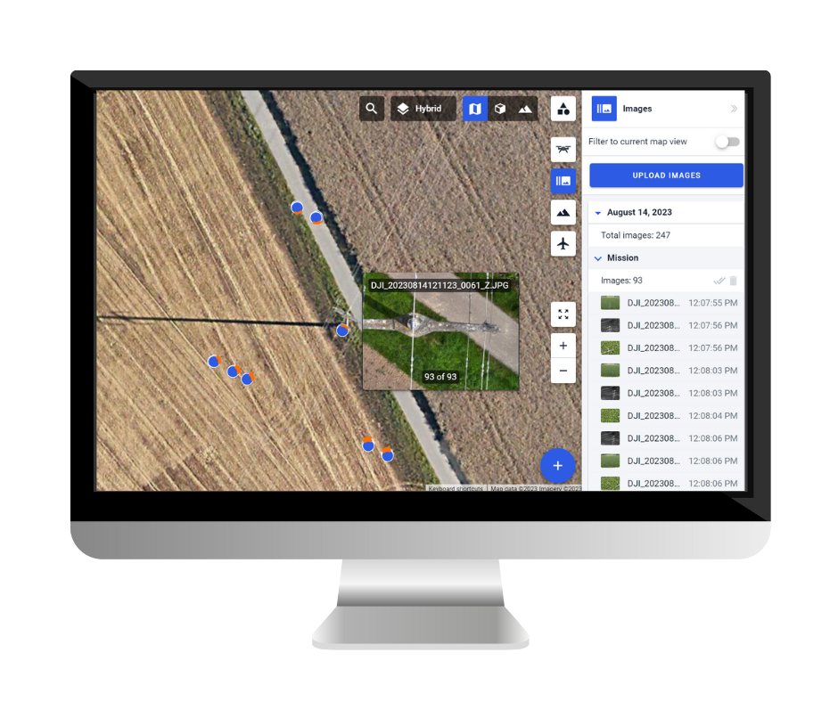
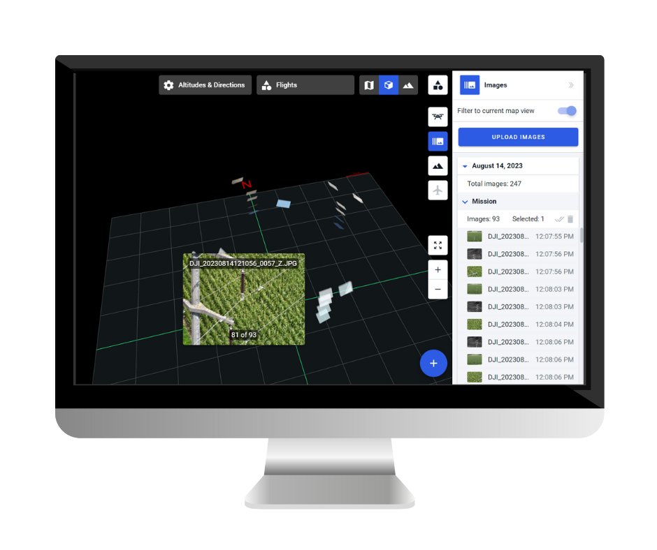
Image Gallery: Unleash the Power of Visual Data Seamlessly upload and manage drone images within the application. Sorting images by time, date, and flight ensures easy accessibility and organization. Furthermore, the system automatically geolocates and overlays the images on Map and 3D views, providing valuable visual context during mission planning and analysis. This feature empowers users to efficiently browse, reference, and leverage captured drone data, unlocking new possibilities for data-driven decision-making.
Upload and manage drone images within Drone Harmony
User Interface Improvements for Large Missions Waypoints are now intelligently grouped when viewing the mission at a zoomed-out level, providing a high-level overview of the mission structure and significantly improving performance. As users zoom in and select specific missions, all individual waypoints become visible, enabling precise customization and control. Additionally, the updated UI displays the drone’s orientation on the map during the mission, allowing users to evaluate flight paths and angles more clearly, ensuring optimal mission planning and execution.
Floating Obstacles for Power Scanner In drone missions, obstacles are no longer limited to ground-level structures. Drone Harmony introduces floating obstacles, eliminating the restriction that previously mandated all obstacles to be grounded at the zero level. With this new feature, you can incorporate obstacles suspended in the air into your mission plans. This advancement opens up possibilities for inspecting elevated structures, navigating around aerial objects, and conducting missions in complex environments with unprecedented accuracy and safety.
Ability to Set Speeds on Waypoints The ability to set speeds on waypoints offers enhanced mission customization and optimization. Drone Harmony’s latest update empowers users to define the drone’s desired speed after passing each waypoint on the map. This feature provides granular control over the drone’s tempo throughout the mission, allowing for dynamic adjustments based on specific requirements or environmental factors. By fine-tuning speed settings, operators can maximize efficiency and adaptability, ensuring more time-efficient execution of complex flight plans.
Enhanced Speed Visualization Understanding and visualizing set speeds during mission planning is crucial for evaluating and optimizing flight behavior. Drone Harmony now offers improved visualization by displaying modified speeds directly on the web interface. This enhanced visualization feature provides an intuitive overview of the drone’s speed settings at each waypoint. Visualizing speed adjustments allows users to validate flight trajectories, anticipate velocity changes, and optimize mission parameters for the desired outcomes, promoting safer and more efficient operations.
Conclusion Drone Harmony’s latest enhancements elevate the drone mission management experience. The image gallery feature is a rich new dimension to the platform that will elevate Drone Harmony’s user experience and unlock new use cases. Other features are directed at enhanced flexibility, mission efficiency, and performance.
Legislative Update On June 18, 2024, the House of Representatives passed the National Defense Authorization Act (NDAA), which includes the “Countering CCP Drones Act.” This bill aims to ban DJI drones by prohibiting their use of FCC communication infrastructure. However, the Senate Armed Services Committee (SASC) has recently released its marked-up version of the 2025...
We’re thrilled to announce a major update that combines all versions of our app into one streamlined platform, providing enhanced convenience and efficiency for both enterprise and professional users. Consolidation of Versions With this update, we have merged all versions of the app into a single comprehensive platform. This consolidation includes: Improved Accessibility Upon opening...
We are thrilled to announce a significant addition to our team. Adam Saciuk, with over twenty years of pioneering experience in industrial operational optimization, inspection, and drone program design, implementation, and execution, has joined Drone Harmony as the Chief Operations Officer for North America. This exciting development marks a pivotal moment in Drone Harmony’s journey...
March 2, 2024
Copyright 2024 Drone Harmony AG. All Rights Reserved.