Access the most powerful 3D data capture software from any web browser. Plan automatically drone missions for complex use cases and easily collaborate on large projects.
Plan Drone Missions with Ease
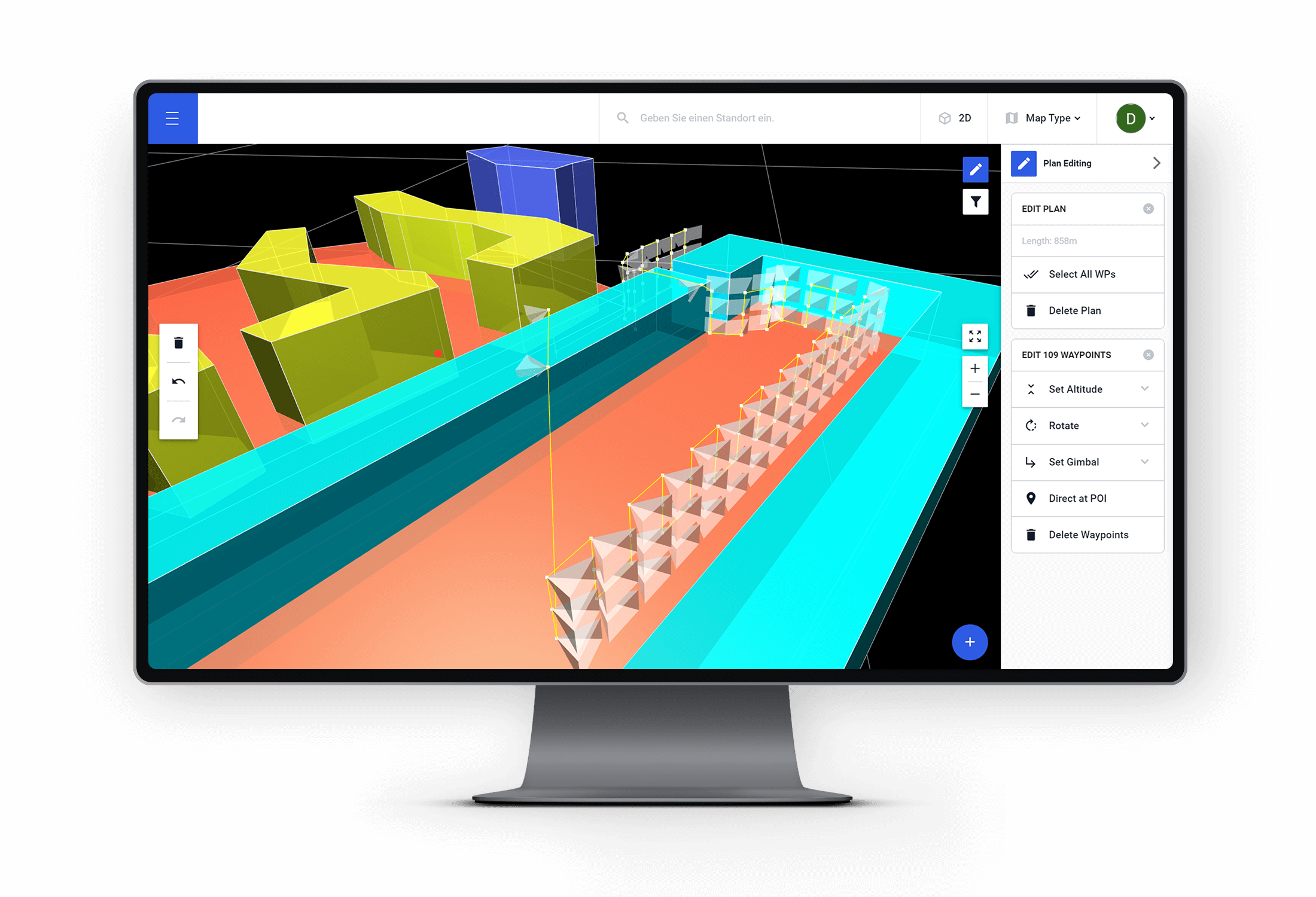
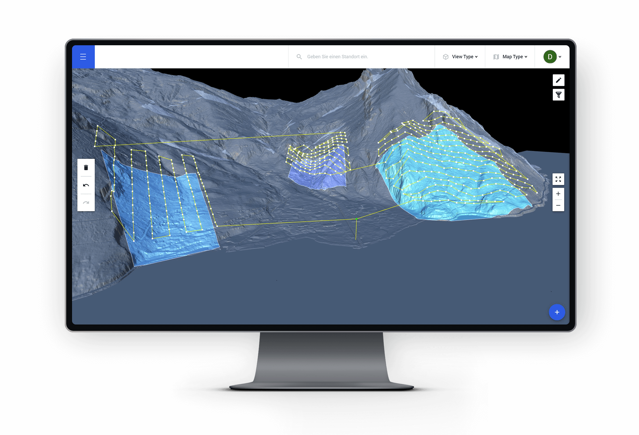
Plan drone flights with Drone Harmony`s automated mission planning engine in the comfort of your office. Focus on setting high-level goals and let Drone Harmony automatically generate optimized plans tailored to your asset`s geometry.
Activate Your Existing Asset Data
Leverage existing asset data, such as CAD and digital elevation models, to accelerate planning and improve the quality of captured data. Access third party data seamlessly through Drone Harmony`s API integrations.
Easily Manage Data from Multiple Inspection Sites
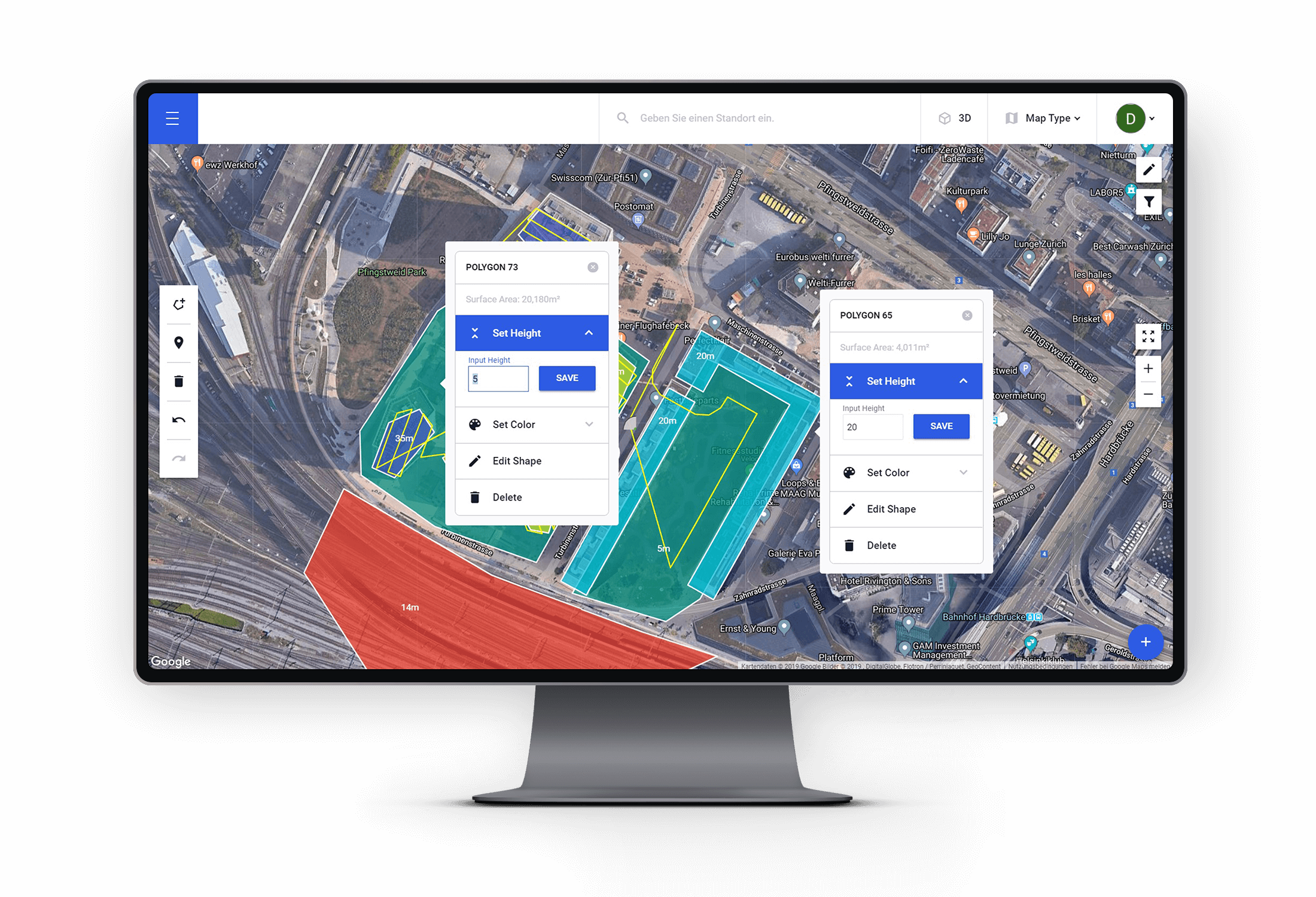
Store all inspection data, including inspection site geometry and flight missions in the Drone Harmony Cloud. Easily manage, share, tag and archive states.
Industries
Business intelligence derived from drone data is only as good as the data that is used to generate it.
What our customers say
Copyright 2024 Drone Harmony AG. All Rights Reserved.


