There are few industries in the drone world that show more promise than the cell tower inspection industry. In this post, we briefly explain why and outline the key role that Drone Harmony is playing in it.
Drone inspection is much safer and cheaper
Cell tower inspections, the majority of which are still conducted by manned inspections, are both expensive and dangerous. Manual cell tower inspection is in fact among the most dangerous jobs, outnumbering deaths per 10,000 workers both police work and logging. Automated workflows have proven their potential to reduce the death toll to zero and cut inspection costs by as much as 50%. Add to that the nearing transition to 5G technology that will require a huge scale-up in the density of cell towers, and you’ve got your answer to why.
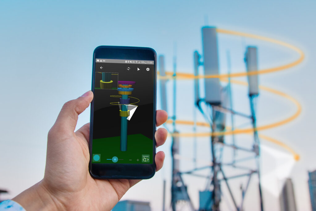
3D visualization of the mission
No drone-based inspections of cell towers at scale up to now
While the hardware has been around for a couple of years now, the related software ecosystem has been lacking, leading to slow and cumbersome workflows from data acquisition, through digital model creation to report generation, thus eating up the aforementioned promised reduction in costs. Furthermore, large site owners were reluctant to deploy drones at scale due to the lack of country-wide service providers, or simple enough end-to-end solutions that could be integrated into their own on-site activities. This is currently changing, and Drone Harmony is playing a key role.
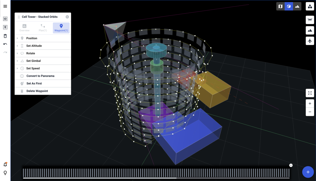
The tower model creation wizard in the Drone Harmony Tower Scan app
Drone Harmony presents an automated capture app tailored for cell tower inspections
This app is based on the Drone Harmony mission planning framework, featuring the scene-centered workflow, 3D planning environment, obstacle avoidance, and more. Missions for flying the tower with a number of capture methodologies can be automatically generated for the defined tower. A simple positioning calibration tool allows you to achieve pinpoint accuracy. Finally, we have stripped the app down to the simplest interface possible, but which still allows performing complex tower scans with a click of a button. Using it literally requires minimal experience with drones and a half-hour training session.
Drone harmony would have to be the best equipped flight planning app I've ever used. It works perfectly for vertical and complex structures, along with a large number of mission types to achieve the best results for your target asset.
Danny Elassad, Chief Remote Pilot,Hoverscape
Drone Harmony is the best Flight Planning Platform I've used to cover the dynamic terrain of our mining business with it's Terrain Following feature.
Muhammad Ilyas, Deputy Manager Mine Planning,Sindh Engro Coal Mining Company (SECMC)
Amazing app, easy to use and powerful. Offers all the things I need for scene inspection of many kinds (towers, antennas, construction sites, private residential zones, etc...). Also good mapping grids and parameters setting.
Jose Benitez, Co-Founder,TucanoRobotics
Excellent application, it is worth going for the paid version. It works perfectly, even with simple drones like DJI Spark.
Luis Eduardo Cuevas Correa, Founder,Lekazo
Obtaining a point cloud of the entire site in a few hours using a drone is a huge benefit to the schedule and the budget.
Jesse Creech, VDC Coordinator,Brasfield & Gorrie
Drone Harmony
proved itself admirably, and we
achieved in automated flight what
would have taken enormous risk
and complexity in manual flight.
Michael Appleyard, CEO,Drone Inspection WA
Setting up our missions in Drone Harmony has been easy thanks to great tutorials and excellent support from the Drone Harmony Team. Thank you!
Dwayne Marx, Founder
With the Drone Harmony application
data acquisition was consistent, the flight
patterns and automation provided
us with consistent high-quality models
for the purposes of tower
inspections.
Stanley du Toit, Solution Architect,The iGlobe Group
Legislative Update On June 18, 2024, the House of Representatives passed the National Defense Authorization Act (NDAA), which includes the “Countering CCP Drones Act.” This bill aims to ban DJI drones by prohibiting their use of FCC communication infrastructure. However, the Senate Armed Services Committee (SASC) has recently released its marked-up version of the 2025...
We’ve added ‘tap focus’, by clicking on any point in a live DJI Dock video feed from your drone, the drone will focus its camera on this designated area. This feature gives users never-before-seen real-time control of their drones, allowing them to pinpoint critical areas with unprecedented precision. In addition, we have also made further...
We’re thrilled to announce a major update that combines all versions of our app into one streamlined platform, providing enhanced convenience and efficiency for both enterprise and professional users. Consolidation of Versions With this update, we have merged all versions of the app into a single comprehensive platform. This consolidation includes: Improved Accessibility Upon opening...