Our new terrain workflow makes planning with a multitude of models a breeze
July 6, 2021
Drone Harmony’s new terrain interface lets you use digital elevation and surface models as easily as you’re using the map layer. The new interface is not just a more comfortable way of using your own models, but it also unlocks the possibility to utilize a host of high-quality country-wide data sets for drone flight planning, which Drone Harmony just started integrating and providing to its Professional and Enterprise customers.
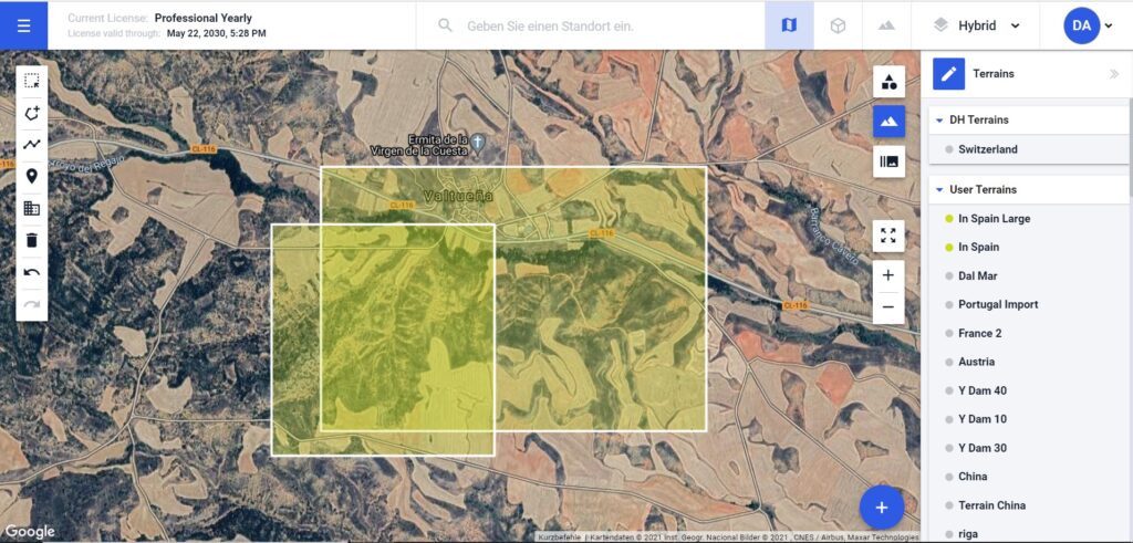
Drone Harmony has a new and improved way of working with digital elevation and surface models (terrains). All user uploaded terrains are now always visible and easily accessible through the terrain layer tab in the right-hand menu. From a user experience perspective, all terrains (custom or public) are now always available in the scene, just like all map tiles of the map layer. Loading a terrain is as easy as clicking on its name in the terrains tab, or zooming in on it in the map.
New terrain workflow in Drone Harmony Web: easy access to all uploaded models as terrains become another overlaid data layer. Terrains currently visible on the map are listed first in the terrains tab.
What does the new workflow enable? Firstly, it enables intuitive menu-free views of all uploaded data sets- both readily overlaid on the map and in a convenient list format. Next, it drastically facilitates work with versioned digital models, as many versions of a model can be loaded at the same time.
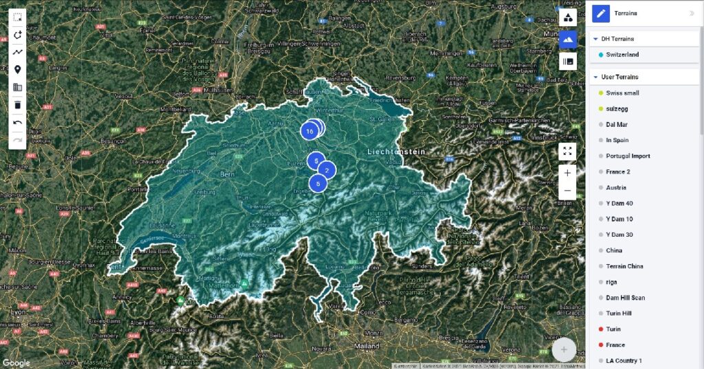
Finally, the new terrain workflow enables easy integration of large country-wide models into Drone Harmony Web. Professional and Enterprise customers will henceforth gain fully integrated access to a multitude of accurate models provided by governments and topography offices. The platform already includes several countries. You will find the list of all covered countries here. Working with these large data sets in the web browser is also just as easy navigating a map, owing to Drone Harmony’s data streaming technology.
Switzerland’s 2×2 meter digital elevation model (Swisstopo) is the first of many data sets made available as a data layer for automated flight planning.
The new terrain workflow underlines Drone Harmony’s dedication to enhancing professional drone workflows by better integrating geospatial data allowing our customers to derive more value from existing data with ease.
Legislative Update On June 18, 2024, the House of Representatives passed the National Defense Authorization Act (NDAA), which includes the “Countering CCP Drones Act.” This bill aims to ban DJI drones by prohibiting their use of FCC communication infrastructure. However, the Senate Armed Services Committee (SASC) has recently released its marked-up version of the 2025...
We’re thrilled to announce a major update that combines all versions of our app into one streamlined platform, providing enhanced convenience and efficiency for both enterprise and professional users. Consolidation of Versions With this update, we have merged all versions of the app into a single comprehensive platform. This consolidation includes: Improved Accessibility Upon opening...
We are thrilled to announce a significant addition to our team. Adam Saciuk, with over twenty years of pioneering experience in industrial operational optimization, inspection, and drone program design, implementation, and execution, has joined Drone Harmony as the Chief Operations Officer for North America. This exciting development marks a pivotal moment in Drone Harmony’s journey...
March 2, 2024
Copyright 2024 Drone Harmony AG. All Rights Reserved.