Drone Harmony’s new terrain interface is not just a more comfortable way of using your own models, but it also unlocks the possibility to utilize a host of high-quality country-wide data sets for drone flight planning, which Drone Harmony is providing to its Professional and Enterprise customers.
Terrain-aware flight planning with detailed terrain data (2-10m resolution) is available for:
- Switzerland
- Austria
- France
- Italy
- Norway
- Australia (densely populated areas and surroundings)
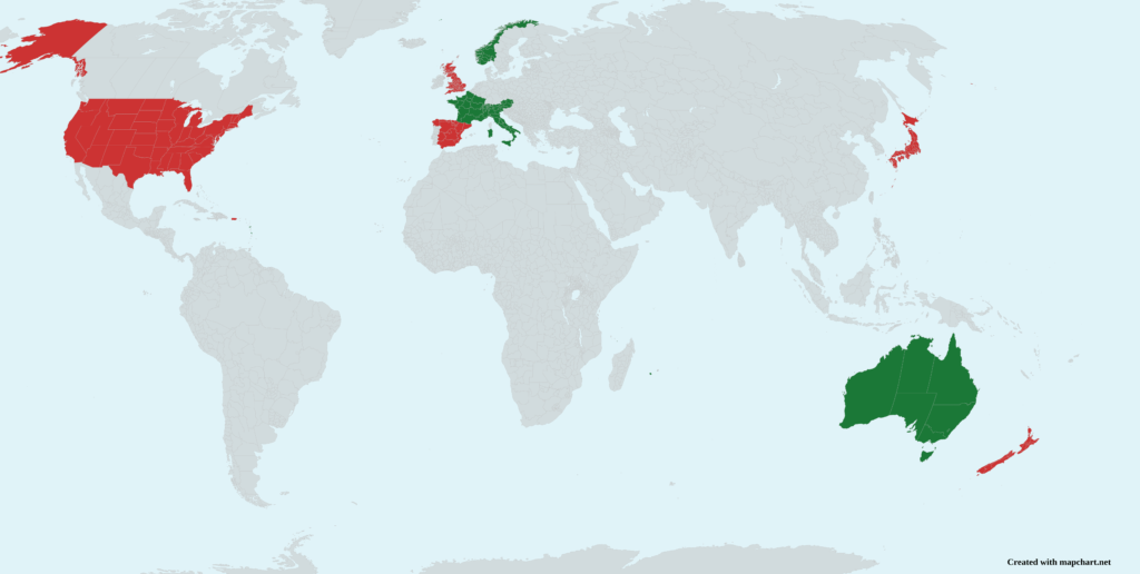
Countries that will be integrated in the near future:
- Spain
- UK
- Japan
- New Zealand
- United States
- Puerto Rico
Drone Harmony has a new and improved way of working with digital elevation and surface models (terrains). All user uploaded terrains are now always visible and easily accessible through the terrain layer tab in the right-hand menu. From a user experience perspective, all terrains (custom or public) are now always available in the scene, just like all map tiles of the map layer. Loading a terrain is as easy as clicking on its name in the terrains tab, or zooming in on it in the map.


