In the near future drone-based automated inspections of roads will replace old and costly inspection methods.
In order to maintain safe roads and prolong their service life, frequent inspections are needed to identify damage in the road, assess vegetation encroachment etc. Previously, this task was very challenging and costly, due to the sheer length of roads, the complex diverse environments they reside in.
Drone-based automated inspections will soon replace old inspection methods. The key is automating the process to be able to reach the needed scale to make the process cost effective.
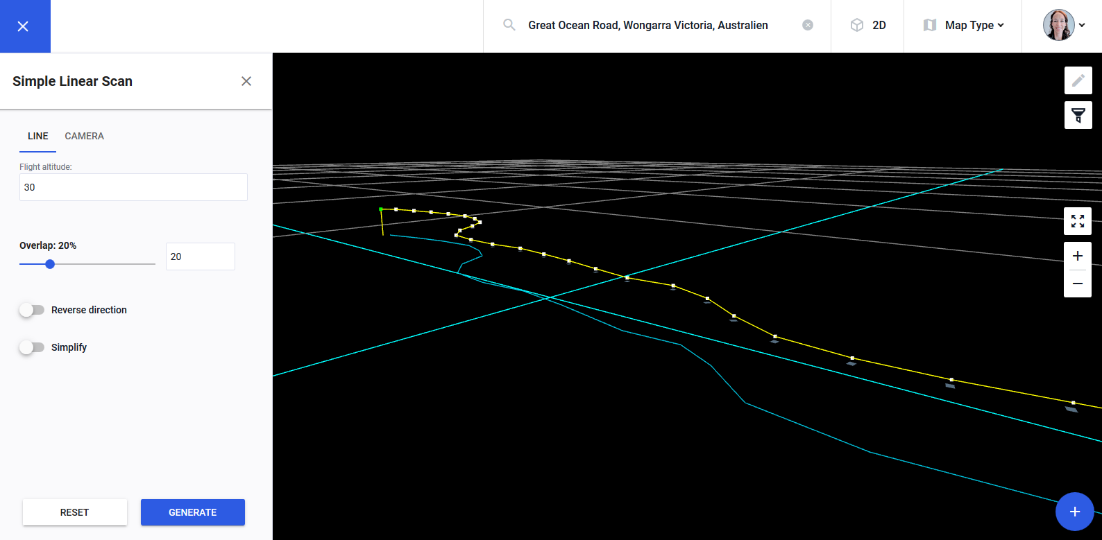
In the following months, our linear scan features will be enriched further and combined with the ability to follow complex terrain. The road scanning solution, featuring the combination of terrain aware flights with linear scan will enable full flexibility in performing road surveys in arbitrary terrain and at arbitrary altitude above ground.
Drone Harmony’s road scanning solution will import both terrain elevation models and models of the road to be scanned. The planned flights will be computed automatically and optimized for the imported data. This is exactly the kind of workflow that enabled the positive outcome in the following use case.
The result will be a simple repeatable workflow enabling to cover many miles of road per day.
A use case
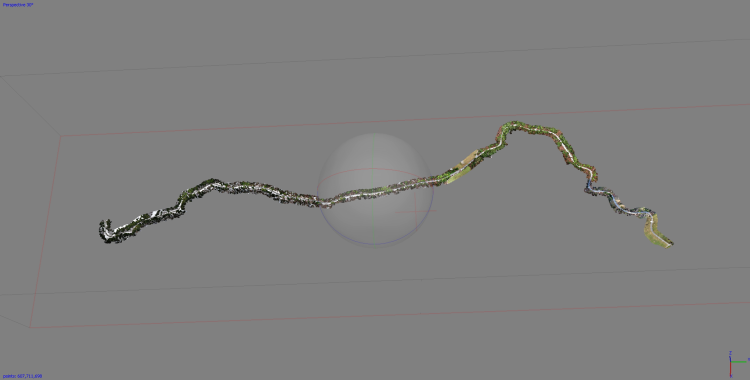
As part of our work towards enhancing our enterprise solution, Drone Harmony has been working intensively on the challenges and solutions of road inspections. We recently collaborated with the Slovenian company IGEA to perform a precise reconstruction of a 11KM stretch of mountain road for an inspection and measurement job issued by the Slovenian government.
The full 11km stretch of mapped mountain road
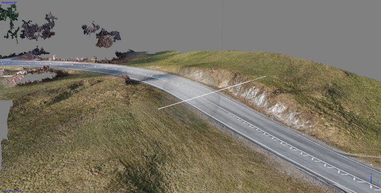
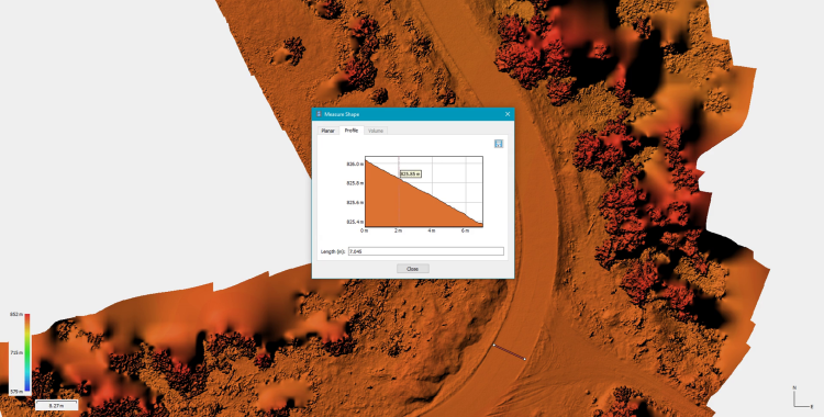
Andraz Krivic from IGEA performed flights using Drone Harmony’s road inspection solution (beta). He collected about 3600 images in only 1.5 days of work with his Inspire 2 platform and generated an accurate 3D model of the road stretch that was used for analysis and measurements. Due to the difficulty of the terrain and complexity of the various obstructions in the scenery, such a task previously required much more time from skilled pilots and the results were of lower quality.
Legislative Update On June 18, 2024, the House of Representatives passed the National Defense Authorization Act (NDAA), which includes the “Countering CCP Drones Act.” This bill aims to ban DJI drones by prohibiting their use of FCC communication infrastructure. However, the Senate Armed Services Committee (SASC) has recently released its marked-up version of the 2025...
We’re thrilled to announce a major update that combines all versions of our app into one streamlined platform, providing enhanced convenience and efficiency for both enterprise and professional users. Consolidation of Versions With this update, we have merged all versions of the app into a single comprehensive platform. This consolidation includes: Improved Accessibility Upon opening...
We are thrilled to announce a significant addition to our team. Adam Saciuk, with over twenty years of pioneering experience in industrial operational optimization, inspection, and drone program design, implementation, and execution, has joined Drone Harmony as the Chief Operations Officer for North America. This exciting development marks a pivotal moment in Drone Harmony’s journey...
March 2, 2024
Copyright 2024 Drone Harmony AG. All Rights Reserved.