We have updated the Drone Harmony platform to include several key enhancements to improve further your enterprise workflow in Drone Harmony. These improvements include a brand new terrain view in DH Cloud, terrain storage, terrain aware flights in DH Cloud and a new billing and invoice management interface.
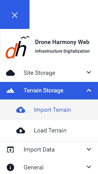
Importing Terrain
Terrain Planning in the Web
Drone Harmony users can now import GeoTiff (*.tif) terrain files in any coordinate system for mission planning through the Drone Harmony web interface. The imported terrain can then be loaded, visualized and navigated in our brand new terrain view, called 3D DEM.
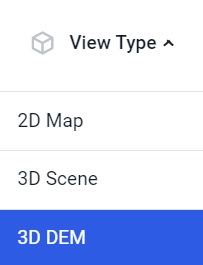
Switching to 3D DEM View
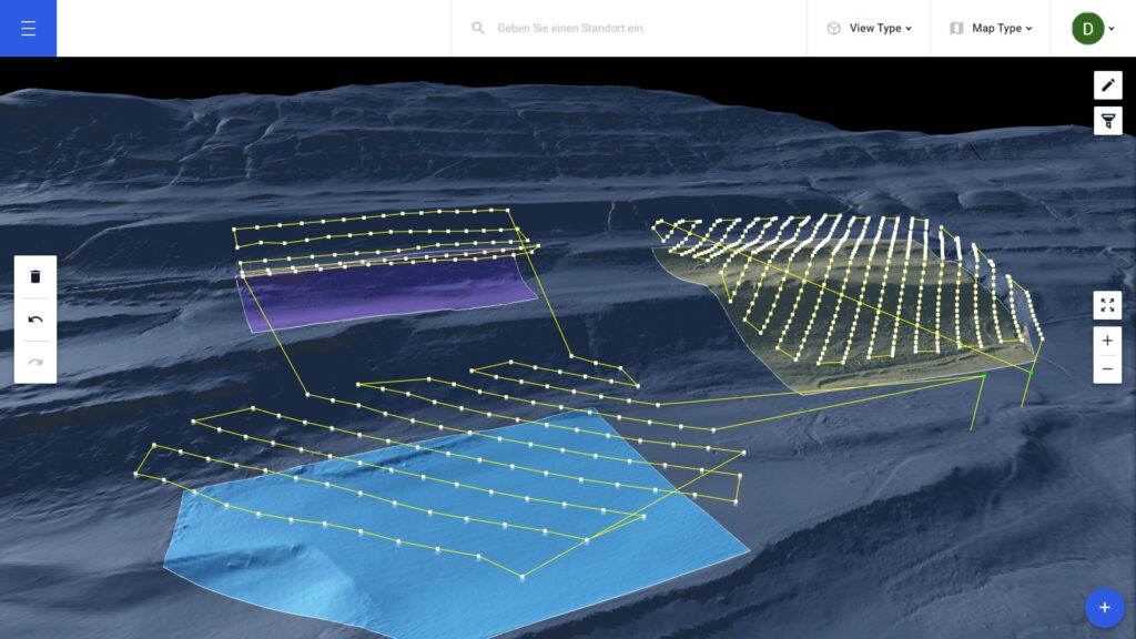
3D DEM view provides a fully immersive 3D view of the terrain represented by the imported data (see below). In case of large terrain files, the navigation in 3D DEM is extremely easy and intuitive: simply drag and rotate the 3D view to see different parts of the terrain, or to change the point of view.
Alongside with the new terrain import and visualization features, we have introduced several powerful automated terrain aware missions. You can plan survey missions with the Terrain Top-Down mission, or plan inspections of linear infrastructure, such as mountain roads, pipelines or electricity lines, just to name a few. Start Drone Harmony Cloud and take a look for yourself.
Planning survey missions in complex terrains using 3D DEM view and terrain aware flights in Drone Harmony Cloud
Questions of Scale
How large can a terrain file be? Each Drone Harmony plan comes with a generous limit on the terrain storage and processing.
Need more space? No problem! There is no limit to the size and geographic coverage of the terrain files you are using with Drone Harmony. Our technology will host and process any number of files of any combined size and make all data available for smooth online mission planning. In fact, some Drone Harmony enterprise customers already maintain terrain models of full countries within the Drone Harmony Cloud, thus eliminating all overheads, confusion and inconsistency caused by fragmented file-based handling of terrain data for mission planning. Reach out to us at contact@droneharmony.com to learn more about terrain hosting.
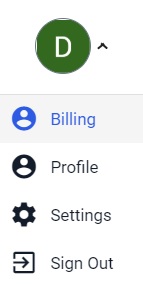
New Interface for Buying and Managing your Drone Harmony Plan
We have also made it easier to buy and manage Drone Harmony plans with a new Billing page in Drone Harmony Cloud. You can now easily buy or upgrade your Drone Harmony plan through the web interface and view and download your past invoices or view future invoices.
Industries
Business intelligence derived from drone data is only as good as the data that is used to generate it.
Drone harmony would have to be the best equipped flight planning app I've ever used. It works perfectly for vertical and complex structures, along with a large number of mission types to achieve the best results for your target asset.
Danny Elassad, Chief Remote Pilot,Hoverscape
Drone Harmony is the best Flight Planning Platform I've used to cover the dynamic terrain of our mining business with it's Terrain Following feature.
Muhammad Ilyas, Deputy Manager Mine Planning,Sindh Engro Coal Mining Company (SECMC)
Amazing app, easy to use and powerful. Offers all the things I need for scene inspection of many kinds (towers, antennas, construction sites, private residential zones, etc...). Also good mapping grids and parameters setting.
Jose Benitez, Co-Founder,TucanoRobotics
Excellent application, it is worth going for the paid version. It works perfectly, even with simple drones like DJI Spark.
Luis Eduardo Cuevas Correa, Founder,Lekazo
Obtaining a point cloud of the entire site in a few hours using a drone is a huge benefit to the schedule and the budget.
Jesse Creech, VDC Coordinator,Brasfield & Gorrie
Drone Harmony
proved itself admirably, and we
achieved in automated flight what
would have taken enormous risk
and complexity in manual flight.
Michael Appleyard, CEO,Drone Inspection WA
Setting up our missions in Drone Harmony has been easy thanks to great tutorials and excellent support from the Drone Harmony Team. Thank you!
Dwayne Marx, Founder
With the Drone Harmony application
data acquisition was consistent, the flight
patterns and automation provided
us with consistent high-quality models
for the purposes of tower
inspections.
Stanley du Toit, Solution Architect,The iGlobe Group
Legislative Update On June 18, 2024, the House of Representatives passed the National Defense Authorization Act (NDAA), which includes the “Countering CCP Drones Act.” This bill aims to ban DJI drones by prohibiting their use of FCC communication infrastructure. However, the Senate Armed Services Committee (SASC) has recently released its marked-up version of the 2025...
We’ve added ‘tap focus’, by clicking on any point in a live DJI Dock video feed from your drone, the drone will focus its camera on this designated area. This feature gives users never-before-seen real-time control of their drones, allowing them to pinpoint critical areas with unprecedented precision. In addition, we have also made further...
We’re thrilled to announce a major update that combines all versions of our app into one streamlined platform, providing enhanced convenience and efficiency for both enterprise and professional users. Consolidation of Versions With this update, we have merged all versions of the app into a single comprehensive platform. This consolidation includes: Improved Accessibility Upon opening...