There are few industries in the drone world that show more promise than the cell tower inspection industry. In this post, we briefly explain why and outline the key role that Drone Harmony is playing in it.
Drone inspection is much safer and cheaper
Cell tower inspections, the majority of which are still conducted by manned inspections, are both expensive and dangerous. Manual cell tower inspection is in fact among the most dangerous jobs, outnumbering deaths per 10,000 workers both police work and logging. Automated workflows have proven their potential to reduce the death toll to zero and cut inspection costs by as much as 50%. Add to that the nearing transition to 5G technology that will require a huge scale-up in the density of cell towers, and you’ve got your answer to why.
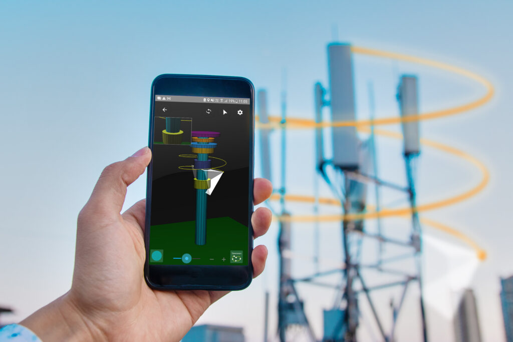
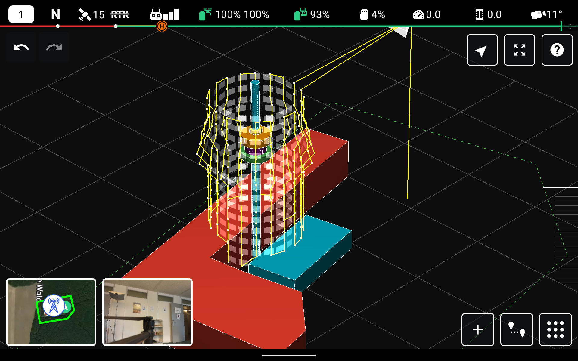
3D visualization of the mission
No drone-based inspections of cell towers at scale up to now
While the hardware has been around for a couple of years now, the related software ecosystem has been lacking, leading to slow and cumbersome workflows from data acquisition, through digital model creation to report generation, thus eating up the aforementioned promised reduction in costs. Furthermore, large site owners were reluctant to deploy drones at scale due to the lack of country-wide service providers, or simple enough end-to-end solutions that could be integrated into their own on-site activities. This is currently changing, and Drone Harmony is playing a key role.
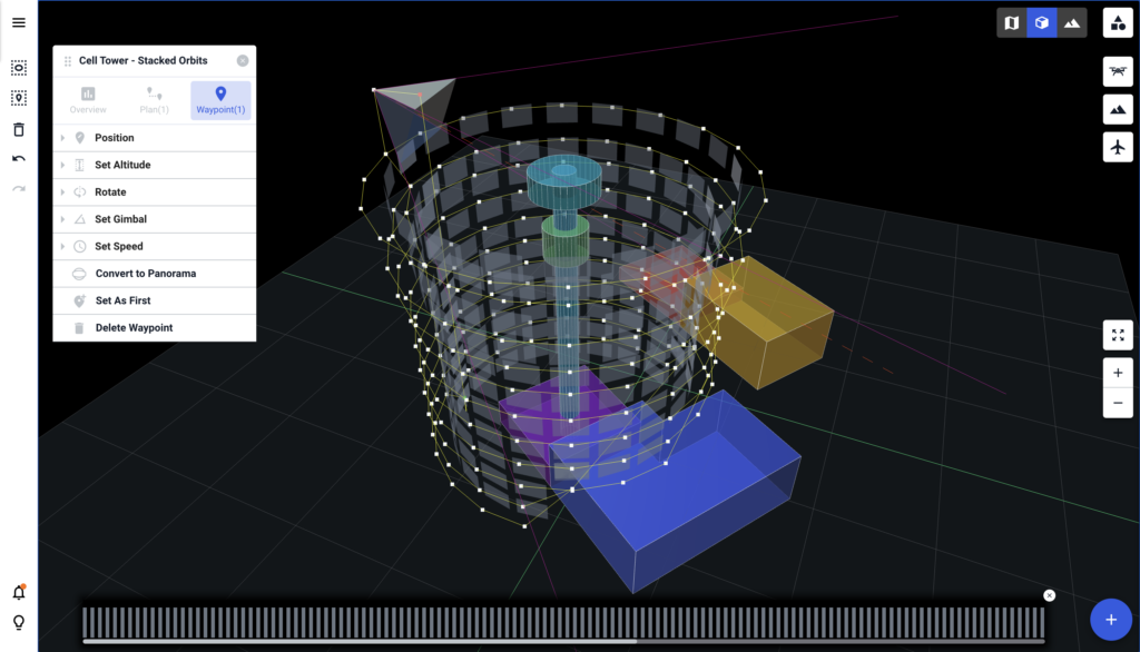
The tower model creation wizard in the Drone Harmony Tower Scan app
Drone Harmony presents an automated capture app tailored for cell tower inspections
This app is based on the Drone Harmony mission planning framework, featuring the scene-centered workflow, 3D planning environment, obstacle avoidance, and more. Missions for flying the tower with a number of capture methodologies can be automatically generated for the defined tower. A simple positioning calibration tool allows you to achieve pinpoint accuracy. Finally, we have stripped the app down to the simplest interface possible, but which still allows performing complex tower scans with a click of a button. Using it literally requires minimal experience with drones and a half-hour training session.
The Drone Harmony Tower Scanner for Cell Tower Inspection continues to evolve, offering an extensive range of new features and enhancements. With its new ability to resume missions, improved translation support, real-time data display, and numerous other updates, the app is a valuable tool for tower and antenna inspections. In this blog post, we will...
Drone Harmony has released a new update for its professional drone mission planning software for commercial use. The software now supports all new DJI Enterprise drones, including Mavic 3 Enterprise Thermal, Matrice 30 Thermal, and Matrice 300 RTK. The highlight of the recent release is the new support of the DJI’s Matrice 30 and Mavic...
Drone Harmony and Phase One team up to deliver the best solution for high-resolution precision inspection and mapping, combining Phase One’s unparalleled image quality delivered by the P3 payload with Drone Harmony’s Data Acquisition Platform. For the full press release, visit this page. Drone Harmony now supports Phase One’s flagship payload for drone inspection and...
July 14, 2022
Copyright 2024 Drone Harmony AG. All Rights Reserved.