Ecological Research: Drone Harmony is a Great Help in Alaska
May 6, 2022
Randy Fulweber, GIS & Remote Sensing Manager for Toolik Field Station at the University of Alaska Fairbanks, makes use of Drone Harmony for research, monitoring and mapping the progression of once permanently frozen ground (permafrost) in northern Arctic Alaska. We were invited to talk with him.
Randy, please introduce yourself
I am the manager of the Toolik Field Station GIS and Remote Sensing Department, but I started my adventure with Toolik in 2008 as an analyst and field technician. My staff and I work closely with visiting scientists to integrate geospatial data and analysis into their research. During the relatively warm Alaskan summers, we battle mosquitoes to collect UAS and other geospatial field data in some of the most remote and beautiful areas in northern Alaska. During the cold winters, we return to our warm offices at the University of Alaska Fairbanks to process and analyze the data we collected and deliver products to our colleagues.
For what research do you use Drone Harmony?
We use Drone Harmony exclusively to plan and execute our UAS flights in northern Arctic Alaska, where we support ecological research, such as monitoring and measuring changes in plant phenology across different tundra communities and mapping the progression of snow melt across landscapes. Drone Harmony has been especially helpful in planning and executing UAS flights in support of thermokarst research.
Thermokarsts As the Arctic becomes warmer and wetter, pockets of once permanently frozen ground (permafrost) are beginning to thaw causing the formation of sinkholes known as thermokarsts. When individual thermokarsts form and expand, an influx of soil nutrients and sediment are transported into streams and lakes, which can change the water chemistry and may have potentially negative impacts to local food webs.
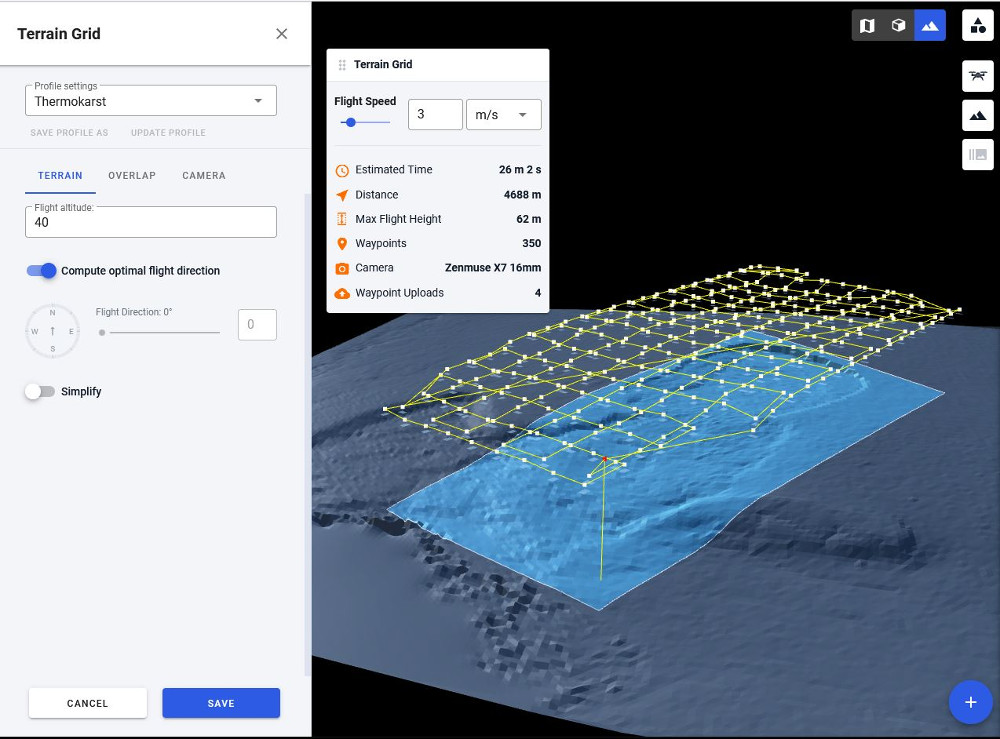
Toolik Field Station (TFS) scientists have been studying thermokarsts in northern Alaska for more than a decade. As the prevalence and size of thermokarsts have increased throughout our region, the tools and techniques we once used to measure and map these features quickly became inefficient. Using traditional field survey techniques, our field team of 3-4 people would need 4-8 hours to complete measurements of a single thermokarst. Now with our drones and DH, our field team can image an entire thermokarst in about 2 hours. From this image, we can complete measurements of the thermokarst from our office computers. Especially important to our research, the terrain-aware function in Drone Harmony has enabled us to more accurately track volumetric changes in soil erosion and deposition within thermokarsts over time.
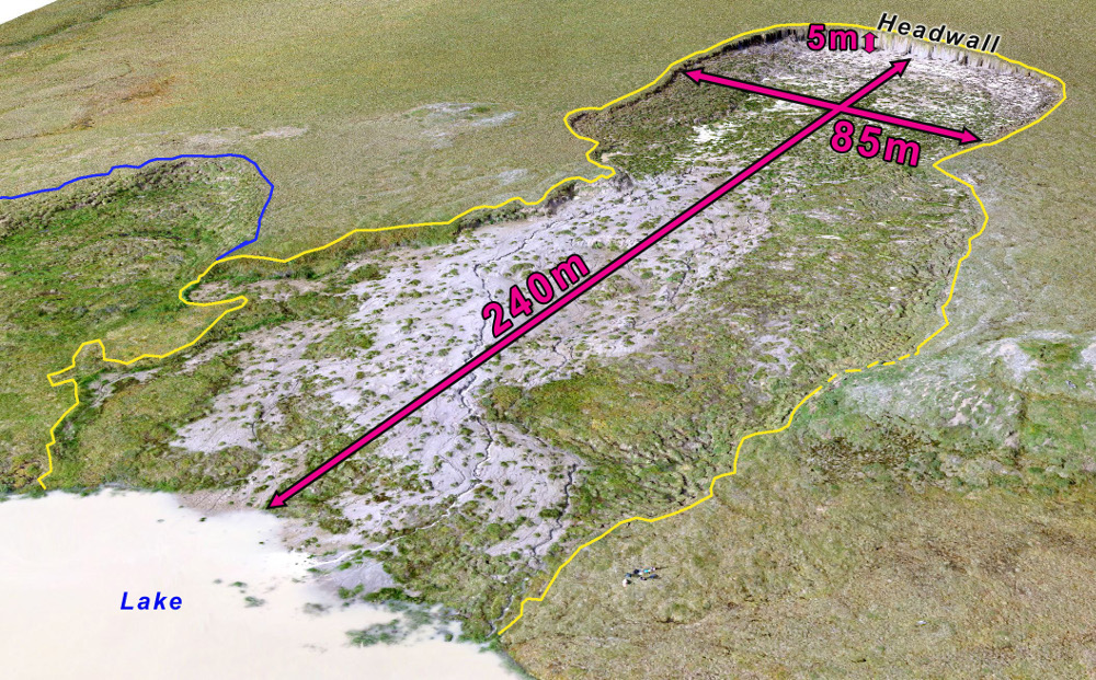
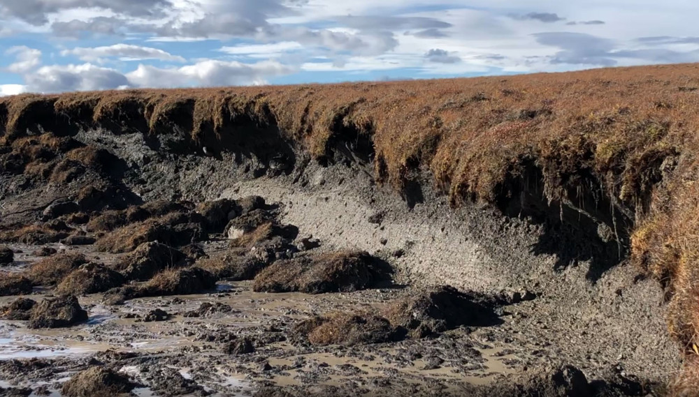
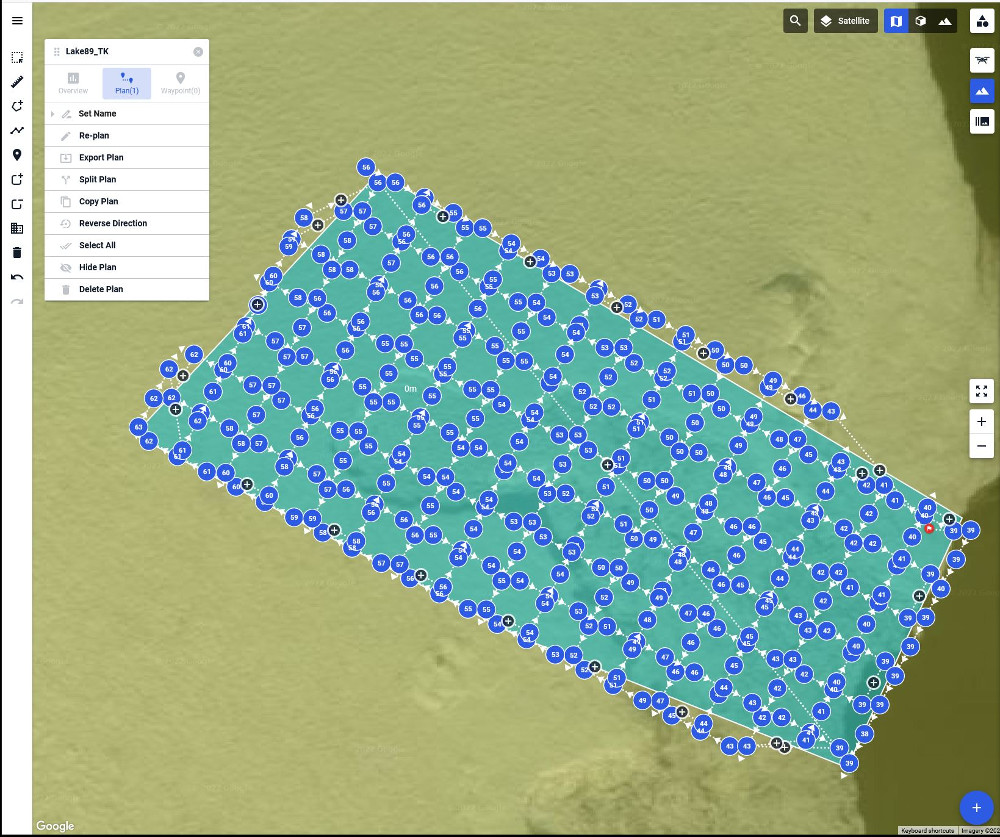
The yellow line delineates the perimeter of an active thermokarst. Within the yellow perimeter, the grey-colored areas are a slurry of thick, muddy, thawed permafrost soil slowly sliding down the hillslope and into the lake located in the bottom left corner of the photo. The white cloudy color of the lake water is a result of high soil deposition. The patchwork of green colored areas within the yellow line are clumps of vegetation. The blue line delineates the perimeter of an older thermokarst that is no longer active and is undergoing revegetation. The thermokarst headwall – site of active thawing of permafrost soilThermokarst flight planning with Drone Harmony terrain view.Thermokarst flight planning with Drone Harmony 2d view.
Which drones and cameras do you use?
We fly two drones: a DJI Matrice M210 v2, and a DJI Matrice M210 v2 RTK. To produce high resolution imagery and Digital Elevation Models, we collect imagery with a DJI x4s camera or a DJI x7 camera with a 16mm or 24mm lens. To support vegetation research we use a Micasense RedEdge MX camera. We use a Klau Geomatics PPK system to improve the accuracy of the GPS coordinates written to each photograph.
What are the challenges that you are facing when performing your work?
In northern Alaska, weather windows that allow for safe drone flights are often short. The ability to preplan flights with Drone Harmony in the office and to make rapid adjustments in the field has been invaluable.
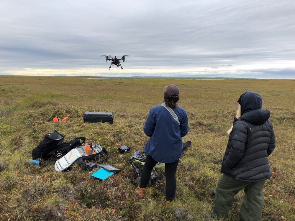
After a soggy 1.5km hike across tussock tundra, Pilot-in-Command Rowan McPherson (r) monitors Olivia Cronin-Golomb (l) as she pilots our DJI Matrice M210 fitted with a DJI x4s camera and a Micasense multispectral camera to capture images of tundra vegetation on the North Slope of Alaska.
Are drone inspections in general already established for your kind of work and studies?
In our field of research, there is rapid growth in the use of drones to record environmental change across broad spatial scales while maintaining high levels of detail. Some of the data that DH helps us collect has been shared with the High-Latitude Drone Ecology Network (HiLDEN), a group of ecologists who specialize in the use of drone technology to capture ecological data across the Arctic.
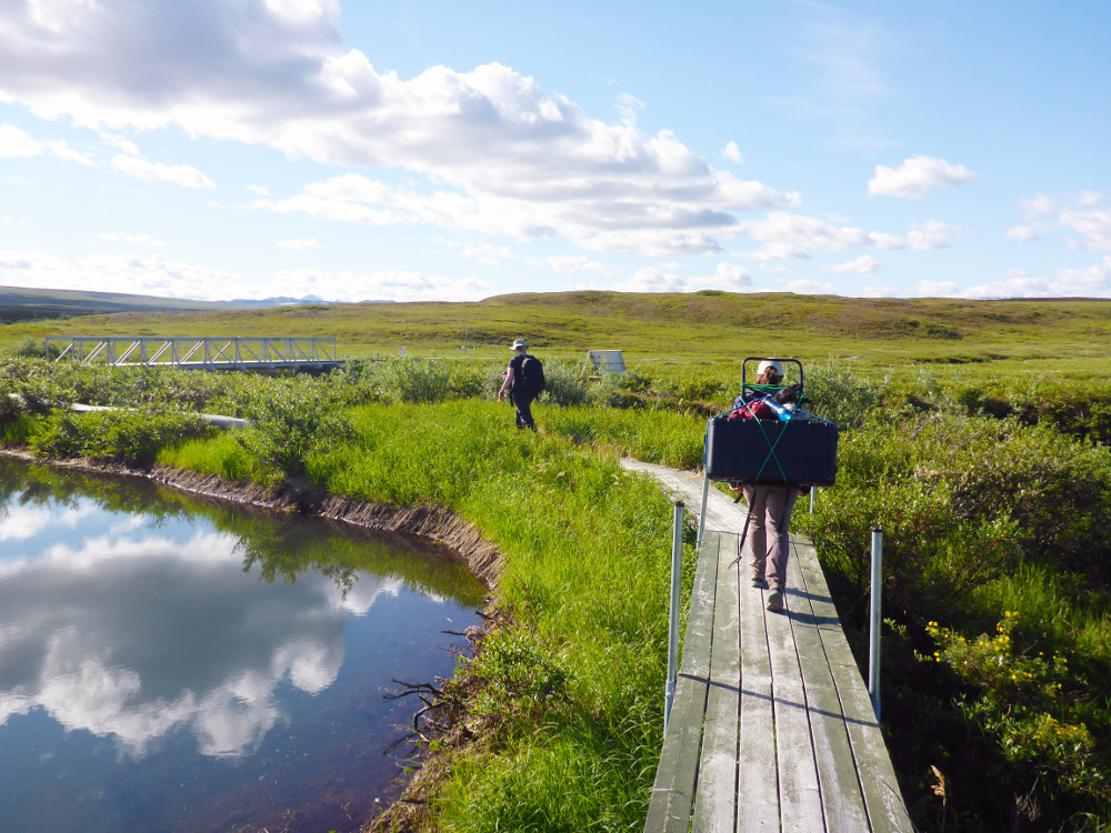
On our way to fly our drone in our “backyard”. The area immediately south of Toolik Field Station is home to a variety of research projects. Access to this area is via elevated boardwalk which protects the delicate vegetation from heavy foot traffic. Rowan (l) leads the way carrying a 20lb backpack full of drone batteries and accessories while Olivia (r) packs our drone in its case.
How much time do you need for planning and executing the mission?
For us, flight planning with Drone Harmony begins in the office and takes less than 15 minutes. Once we arrive at a research site, we often need to make slight alterations to our flight plan on our drone tablet to account for unexpected terrain features or conditions. Thanks to the user interface, we can make and save edits in less than 5 minutes and then immediately execute the flight plan.
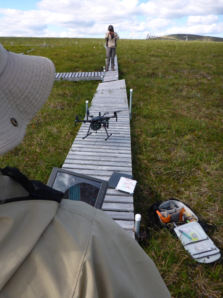
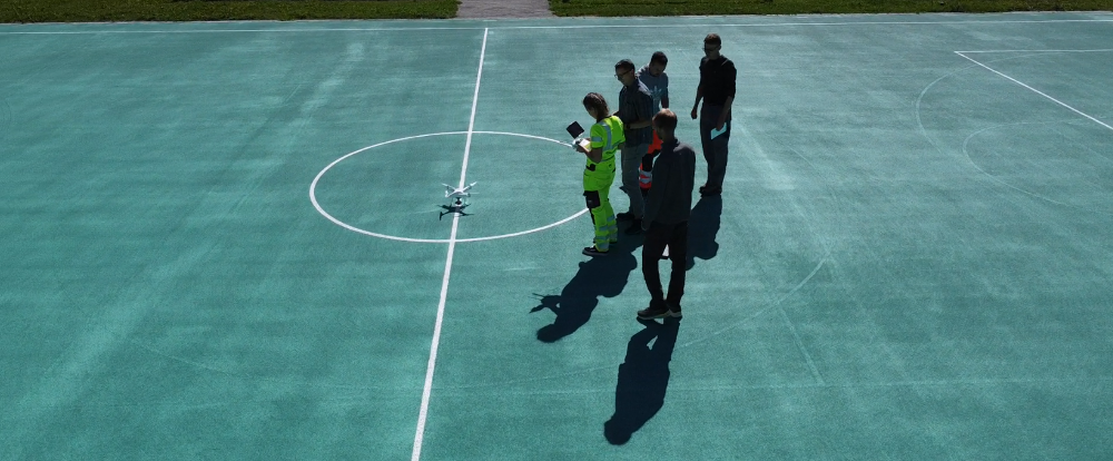
Jorge Noguera (top) acts as Visual Observer to monitor the airspace and keep the flight area free of curious pedestrians while Rowan (bottom) carefully lands the drone.
What did using Drone Harmony enable for your research?
The most important feature to us is the ability to use custom DEM files to plan and execute terrain-following flights. This feature enables our drones to follow the contours of the terrain and allows us to make more accurate calculations from our image products then would otherwise be possible.
Another favorite feature of ours is the ability to resume flights. We have many large flight areas that require multiple drone battery swaps to complete the mission. With Drone Harmony, we can change the batteries and immediately resume a flight where it left off, helping us to efficiently complete long missions without having to manually edit flight plans to remove completed waypoints.
Rowan launches our drone at a hillslope research site near Toolik Field Station.
Do you have other thoughts you would like to share with us?
Drone Harmony makes it easy to plan and execute flights. Even the most novice of our student interns and seasonal employees can readily pick up the skills necessary to operate our drones, allowing them to effectively participate and contribute to our drone research. It is exciting and rewarding to watch their confidence and enthusiasm grow as they quickly gain experience with Drone Harmony’s user-friendly interface.
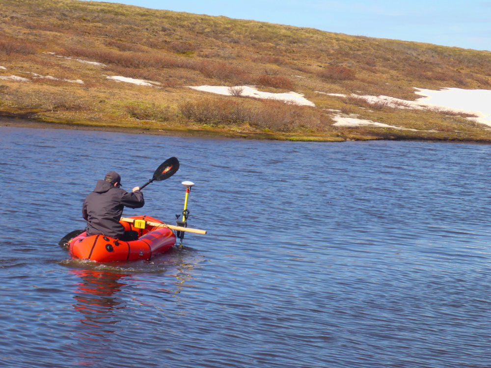
To supplement our drone data, Reyce Bogardus (now a PhD student with the University of Alaska Fairbanks’ Arctic Coastal Geoscience lab) paddles an inflatable pack raft rigged with our sonar and GNSS equipment to collect 3D bathymetric data of a research lake.
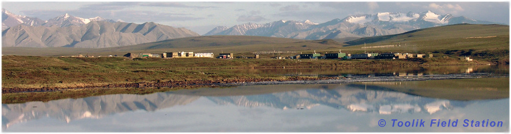
Toolik Field Station (TFS) is a research station located in northern Alaska, operated by the Institute of Arctic Biology at the University of Alaska Fairbanks, and receives base funding support from the Office of Polar Programs at the National Science Foundation. TFS welcomes scientists from the US and around the world.
Toolik Field Station northern Alaska
Thank you Randy for these exciting insights into your work and keep up the safe flights!
Stephan Nebiker, Professor of photogrammetry, remote sensing, and geoinformatics at the Institute of Geomatics Engineering of FHNW, uses Drone Harmony in bachelor and master photogrammetry classes. He teaches students the processes of digital aerial photogrammetry. We were invited to talk with him. Stephan, please introduce yourself. I am a photogrammetry, remote sensing, and geoinformatics professor...
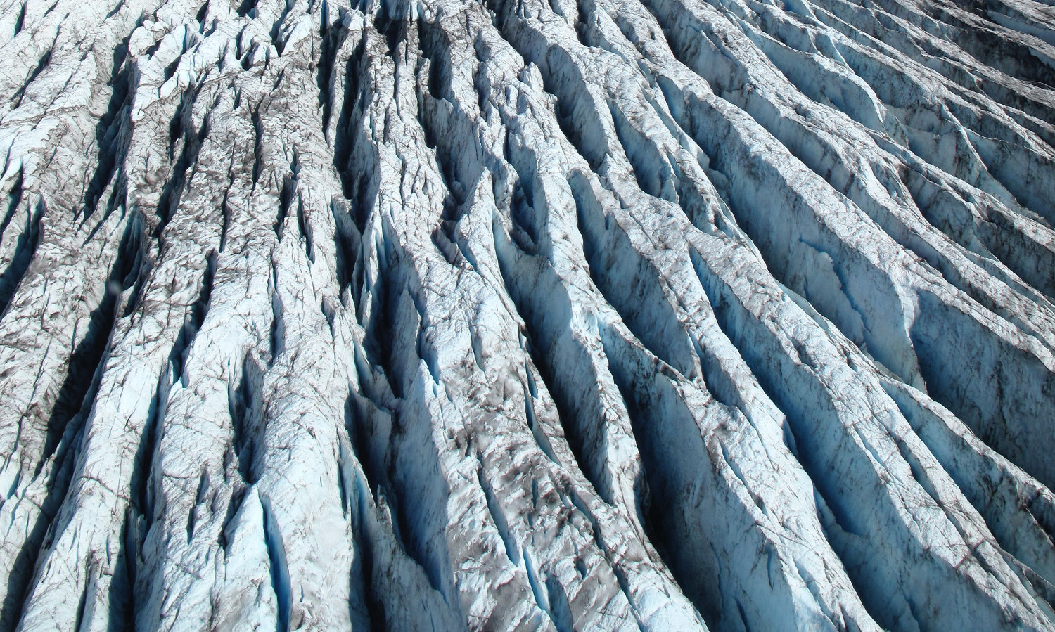
Guillaume Jouvet, Senior researcher in the Department of Geography of the University of Zurich, uses Drone Harmony’s terrain-aware data acquisition for research, monitoring, and mapping of the motion of glaciers in Greenland and Switzerland. We were invited to talk with him. Guillaume, what is your research about? As a mathematician and a glaciologist, I’m working...