How A Professor teaches His Students Photogrammetry in a Visual and Interactive Way
March 10, 2023
Stephan Nebiker, Professor of photogrammetry, remote sensing, and geoinformatics at the Institute of Geomatics Engineering of FHNW, uses Drone Harmony in bachelor and master photogrammetry classes. He teaches students the processes of digital aerial photogrammetry. We were invited to talk with him.
Stephan, please introduce yourself.
I am a photogrammetry, remote sensing, and geoinformatics professor at the Institute of Geomatics Engineering of FHNW, focusing on teaching and researching 3D imaging, mobile mapping, and UAV-based photogrammetry and remote sensing.
How are drones employed in the field of geomatics?
Combining a drone with a camera or a LiDAR sensor and a geo-positioning system opens the field of aerial photogrammetry without the need for an expensive airplane flight, allowing one to collect and elaborate aerial images and data easily.
How will the mapping and surveying data be technically used to generate insights?
From the collected data, with the help of photogrammetry software, geomatics engineers can create georeferenced orthophotos, elevation models, point clouds, or 3D models of an area of interest. All these products can be employed in various applications, ranging from land management/development, slope monitoring, urban planning, agriculture, environmental monitoring, and many others.
Drone Harmony’s web-based planning tool is excellent for classroom and field-course settings as well as interactive learning. It is very visual, it covers many important use cases of drone data collection and it allows us to easily illustrate both simple and advanced concepts in one interface. Students can also gain valuable field experience with the flight app.
Stephan Nebiker, Professor of photogrammetry, remote sensing, and geoinformatics at the Institute of Geomatics Engineering of FHNW
Are drone inspections, in general, already established for this field of application?
In recent years, with the development of new sensors and the increasing efficiency of drone technology, the use of drones in buildings and facility inspection has increased.
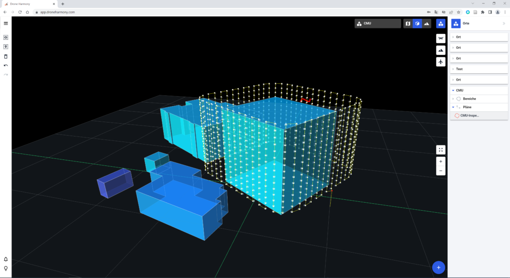
Building and facility inspection planned in Drone Harmony Web
Which are the learning goals of the photogrammetry education program?
In the photogrammetry modules, the students approach the processes of digital aerial photogrammetry with theory and practical implementations. They start with the most important properties of modern airborne sensors and the basics of single and multi-image orientation. Then they master the leading methods for direct and integrated georeferencing and DEM, orthophoto, and 3D model generation. They gain knowledge to efficiently plan and execute surveying missions with drones and the quality of the generated products.
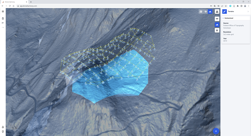
Terrain view of a flight mission in Drone Harmony Web
How do you employ Drone Harmony?
We use Drone Harmony particularly in the bachelor program to show the students a practical application of the theory and methods learned regarding mission planning and execution with a drone. In addition, the software is adopted within projects of the master program or for our research projects to plan the missions rapidly when aerial data is required.
How is the instructional program structured and themed throughout the year?
During the 3rd semester of the bachelor’s degree, the students are introduced to the theme with theory and practical exercises on the whole workflow of digital aerial photogrammetry. In this context, they can verify their flight plan calculations with the help of Drone Harmony, as well as execute their missions to collect the data, which will be elaborated further during the semester.
How will the skills gained through this training benefit students in their future academic or professional careers?
One of the main fields of geomatics is photogrammetry, especially when it comes to geo-referenced data. Creating digital terrain models, orthophotos, and 3D models, and planning and executing building and infrastructure inspections are recurrent tasks for geomatics engineers. All the necessary skills to carry out these tasks are gained during the bachelor program. These skills are also helpful to continue the education beyond the bachelor, especially if one would like to pursue further the fields of computer vision and digital image processing.
Which drones and cameras do you use?
We have some DJI Phantom 4 Pro, a couple of fixed wings eBee, and the last addition to the fleet, a DJI Mavic 3 Thermal.
Thank you, Stephan, for these exciting insights into your work, and keep up the safe flights!
Guillaume Jouvet, Senior researcher in the Department of Geography of the University of Zurich, uses Drone Harmony’s terrain-aware data acquisition for research, monitoring, and mapping of the motion of glaciers in Greenland and Switzerland. We were invited to talk with him. Guillaume, what is your research about? As a mathematician and a glaciologist, I’m working...
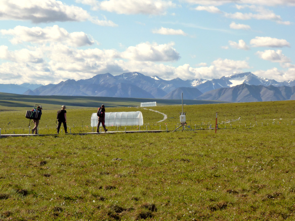
Randy Fulweber, GIS & Remote Sensing Manager for Toolik Field Station at the University of Alaska Fairbanks, makes use of Drone Harmony for research, monitoring and mapping the progression of once permanently frozen ground (permafrost) in northern Arctic Alaska. We were invited to talk with him. Randy, please introduce yourself I am the manager of...
May 6, 2022
Copyright 2024 Drone Harmony AG. All Rights Reserved.