How does Drone Harmony solve the Cell Tower Inspection Pilot’s Problems?
April 16, 2022
Drone Harmony’s Tower Scanner is the first application designed solely to capture data at cell sites with a drone.
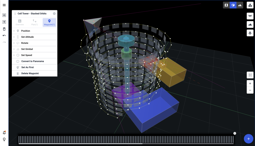
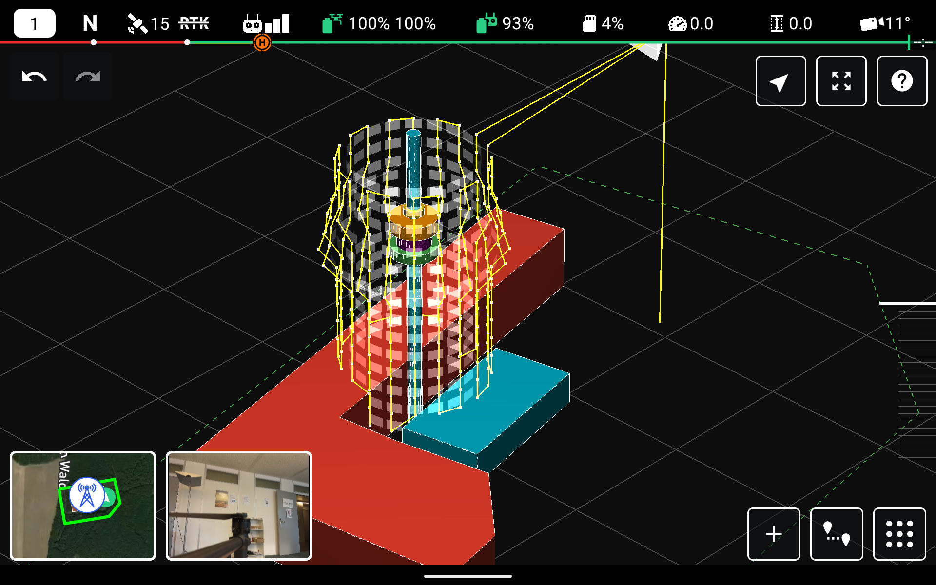
In a nutshell, Drone Harmony has made it as easy as possible for the pilot to obtain the quality data needed for this task. The flight plans in Drone Harmony are generated automatically and are tailored to a rough 3D model of the inspected tower. The model can be either imported or easily constructed in the application using a simple wizard.
Obstacles can also be included in the model and the generated plans avoid these obstacles automatically. Every step of the simple setup procedure is visualized in 3D, so there is very little uncertainty or room for error. Finally, the app flies the drone automatically.
3D planning in Drone Harmony web app
Cell Tower Scan is designed to replace the previously used processes consisting of either manually flying the drone, or manually planning a flight path by placing waypoints in a 2D interface. Both processes represent a much longer, less accurate process, often requiring re-runs due to missing data, and highly skilled pilots. Another issue with a manual flight around cell towers is radio interference, which magnifies the errors and inaccuracies associated with the manual process.
Drone Harmony has developed Cell Tower Scan in close collaboration with Bentley’s Reality Modelling team to guarantee that the data captured by the app is ideal for Reality Modelling and 3D reconstruction. Together with Bentley Systems, Drone Harmony has also worked with a number of companies collaborating directly with pilots and clients to guarantee that the end-to-end solution delivers both the required quality of results and that the app achieves the cost-saving targets.
The Drone Harmony Tower Scanner for Cell Tower Inspection continues to evolve, offering an extensive range of new features and enhancements. With its new ability to resume missions, improved translation support, real-time data display, and numerous other updates, the app is a valuable tool for tower and antenna inspections. In this blog post, we will...
Drone Harmony has released a new update for its professional drone mission planning software for commercial use. The software now supports all new DJI Enterprise drones, including Mavic 3 Enterprise Thermal, Matrice 30 Thermal, and Matrice 300 RTK. The highlight of the recent release is the new support of the DJI’s Matrice 30 and Mavic...
Drone Harmony and Phase One team up to deliver the best solution for high-resolution precision inspection and mapping, combining Phase One’s unparalleled image quality delivered by the P3 payload with Drone Harmony’s Data Acquisition Platform. For the full press release, visit this page. Drone Harmony now supports Phase One’s flagship payload for drone inspection and...
July 14, 2022
Copyright 2024 Drone Harmony AG. All Rights Reserved.