We are happy to announce the new version of our Android application! Better user experience, more features and simpler setup are only part of the included improvements.
Drone Harmony is pleased to announce the release of a brand new version of Drone Harmony Mobile for Android. The new app is based on our learnings and interactions with thousands of customers, that cumulatively performed hundreds of thousands of commercial flights in over five years. We are grateful for all the inputs you have provided, both through the beta testing program, as well as the continuous usage of our mobile apps.
A new powerful user interface
The new Drone Harmony Mobile app is still based on Drone Harmony’s powerful scene-based workflow. However, to make working with the app more intuitive and productive, significant user interface changes were introduced.
We present some highlights from the new app. wherever it is instructive, we compare the new app’s interface with that of our previous (hereafter “legacy”) mobile app.
One of the key improvements is related to interaction and interchangeability of the three main screens: map view, 3d view and FPV view. Unlike older versions of the app, the new app always presents all three views (if the drone is connected) at the same time, with one of the view maximized, while the other two are visible on the bottom left part of the screen. Maximizing a screen amounts to simply tapping on it. This allows the user to always maintain a contextual view from all screens, while focusing on one of them.
All three screens visible at the same time in the new app.A cleaner and simpler interface in 3D view (left: legacy app; right: new app).
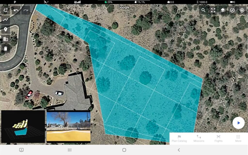
We have changed the style of the plan catalog to match the that of the Drone Harmony Web application. In addition, the automated flight planning tools reflect better the tools in the web app.
Left: old plan catalog. Right: new plan catalog
For example, all terrain-aware flight planning features are now also available in the mobile app, any time the mobile device is connected to the internet.
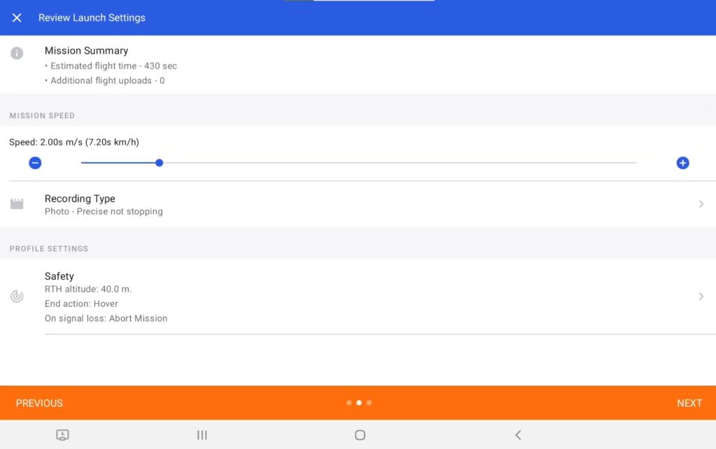
We have significantly improved the launch dialogue, the choice of flight modes and mission resume workflow. Missions can now be executed in both automated and Auto-fly & Manual Shoot capture modes. Mission resume options are now more flexible and more intuitive to use.
A more streamlined and informative launch dialog
Furthermore, we have refactored important menus in the application. For example, while loading sites, you can now see a preview of the site in 2d or 3d before you load to easily distinguish and recognize the wanted site.
We have vastly improved the organization of missions and flights, making it easier to access, hide and show them in all views. In addition, it is now much easier to work with a large number of mission and flights in one site.
Simpler workflow for built-in screens, such as the DJI SmartController
We have designed to app to work seamlessly with DJI built-in screens, such as the SmartController. This simplifies significantly the installation and utilization for Drone Harmony for the Mavic Enterprise, M300 and other drone lineups that use a SmartController.
The simplified workflow is enabled in part by a new login option that only required setting up a username and a password independent of Google or Apple accounts. This login option will also be available on the web app.
Features planned for future releases
Some features that were available in the previous versions of Drone Harmony Mobile have yet to make their way into the new mobile app. These features will be added gradually throughout 2022. Some noteworthy examples include cell tower scan for inspecting communication towers and some map tools, such as the lasso tool for waypoints. If you need to access these features, you could use both the legacy app. You can install both mobile apps on your device simultaneously (see the post “How to get the legacy app“).
Webinar on the New Mobile App
TOP TAKEAWAYS:
A quick introduction to our brand new Drone Harmony Android app
Key user experience improvements
New key features
Tips and tricks for both seasoned and new Drone Harmony users
Legislative Update On June 18, 2024, the House of Representatives passed the National Defense Authorization Act (NDAA), which includes the “Countering CCP Drones Act.” This bill aims to ban DJI drones by prohibiting their use of FCC communication infrastructure. However, the Senate Armed Services Committee (SASC) has recently released its marked-up version of the 2025...
We’re thrilled to announce a major update that combines all versions of our app into one streamlined platform, providing enhanced convenience and efficiency for both enterprise and professional users. Consolidation of Versions With this update, we have merged all versions of the app into a single comprehensive platform. This consolidation includes: Improved Accessibility Upon opening...
In the realm of drone mission planning, the utilization of point clouds marks a significant leap forward, offering a multitude of advantages over conventional 2D or 3D methodologies. Let’s delve into how incorporating point clouds into your drone operations will revolutionize your workflow. Advantages of Point Cloud-Based Planning When it comes to enterprise flight operations,...
April 3, 2024
Copyright 2024 Drone Harmony AG. All Rights Reserved.