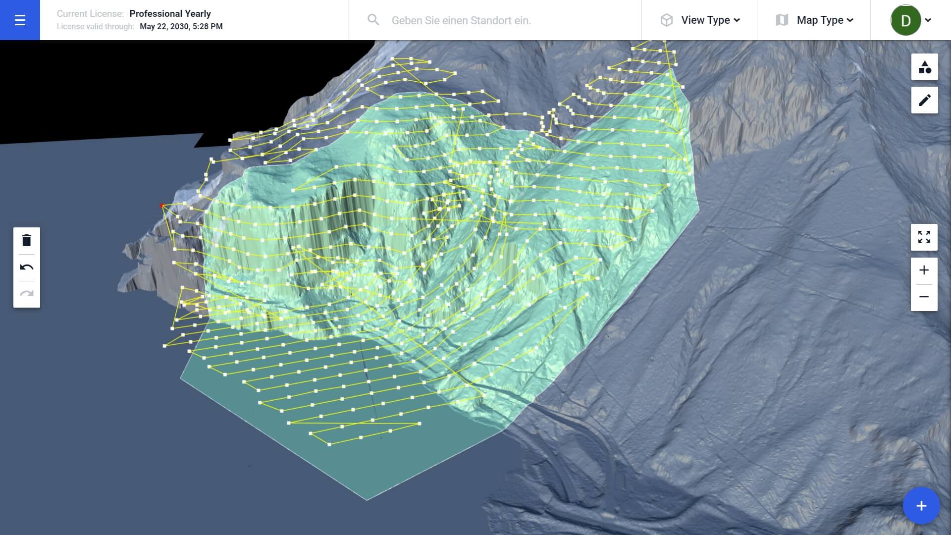
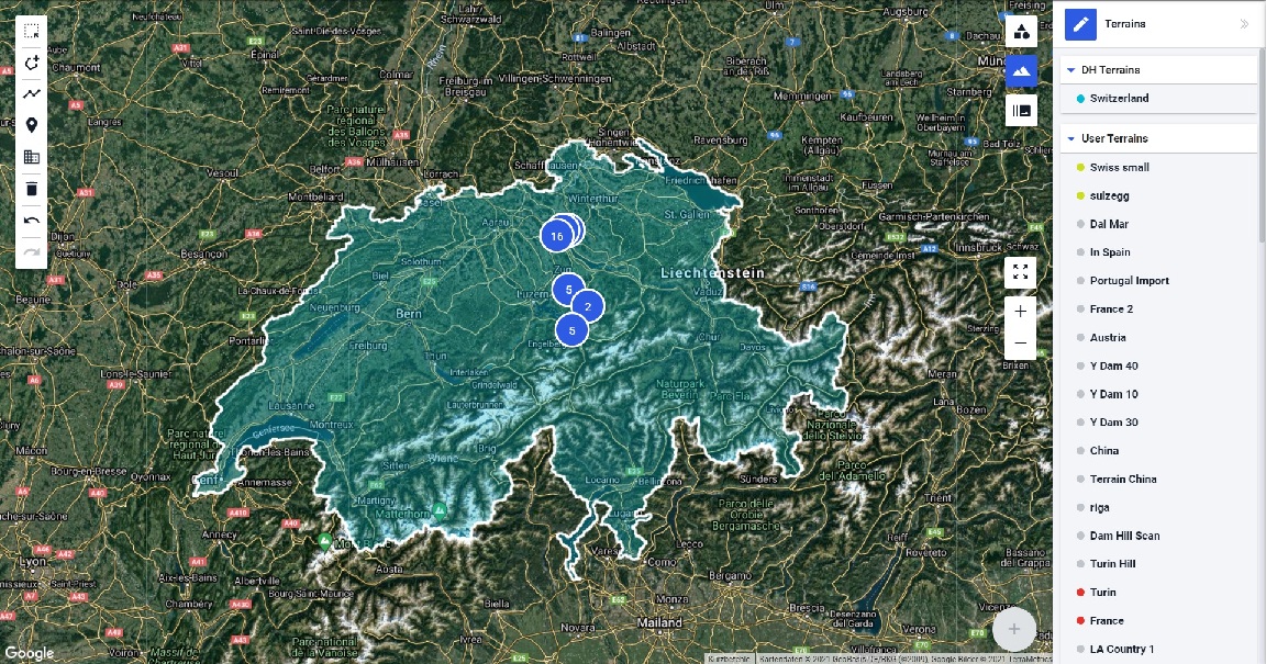
Recent Blog Articles

Bridge Inspection And 3D Defects Analysis by Manam Applications Ltd.

Manam Applications Ltd. and AviSight were awarded a grant from the prestige BIRD Foundation to develop a drone bridge inspection technology, 3D analysis and deliver a full integration and Bridge Management System. Thus enabling efficient, intelligent, fast, and straightforward processes to inspect and easily maintain bridge structures throughout the US & North America and worldwide....

Drone Harmony Bridge Inspection

Autonomous Inspection of Bridges by Bentley Systems

Bridges are among the most challenging infrastructure assets to inspect due to their structural complexity. Yet, regular inspections of bridges are required to assure their safety. The Challenge In a recent project, Drone Harmony collaborated with Bentley Systems to create a detailed 3D model of a complex railway bridge. The main objective of the project...

Subscribe us!
Subscribe for latest updates, news and useful guides.
Subscribe to Newsletter

Drone Harmony Integrates with Altitude Angel to Enhance Safety of Data Acquisition

We have partnered with Altitude Angel, a leader in UTM (Unmanned Traffic Management) software, to provide Drone Harmony customers with in-app airspace information. This integration underlines our commitment to ensure safer flight operation for our customers, as well as our commitment to constantly enrich our data capture platform with high-quality environment data. Drone Harmony continues...

Autonomous missions for the Mavic Mini with Drone Harmony

The support of the DJI Mavic Mini is here! With the recent update, Drone Harmony customers can now plan and execute automated flight missions using the Mavic Mini drone. Drone Harmony has made an extra effort and developed a new way of executing autonomous missions. This was a crucial request from our customers since DJI...

Drone Harmony hits 100’000 flights!

We’re excited to announce that over 100 thousand drone flights have been conducted with Drone Harmony with a cumulative distance of more than twice around the earth. We’d like to thank all our customers for trusting us and sharing their experience using Drone Harmony with colleagues and friends, or online, to strengthen and grow the...

Drone Harmony Partners with Intel Geospatial

Drone Harmony has entered a partnership with Intel Geospatial, a newly released enterprise platform offering a unified platform for data management, visualization and analytics to unlock geospatial insights at scale. The partnership is designed to enable an improved experience for Intel customers needing reliable and scalable drone data acquisition. Drone Harmony Web can now import...

New Terrain Features in Drone Harmony Cloud

We have updated the Drone Harmony platform to include several key enhancements to improve further your enterprise workflow in Drone Harmony. These improvements include a brand new terrain view in DH Cloud, terrain storage, terrain aware flights in DH Cloud and a new billing and invoice management interface. Terrain Planning in the Web Drone Harmony...