Drone Harmony has integrated Altitude Angel’s dynamic airspace map into Drone Harmony Web. As a result, Drone Harmony customers can view up to date airspace information (zones, restrictions etc.) directly in map view, while planning missions.
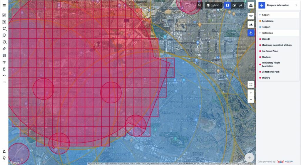
The airspace information layer is toggled by clicking on the airspace toolbar icon on the top-right part of the screen. The airspace information will immediately start to display in the form of overlays in map view. If you are zoomed out too far on the map to display the airspace layers, they will not display and you will be asked to zoom in.
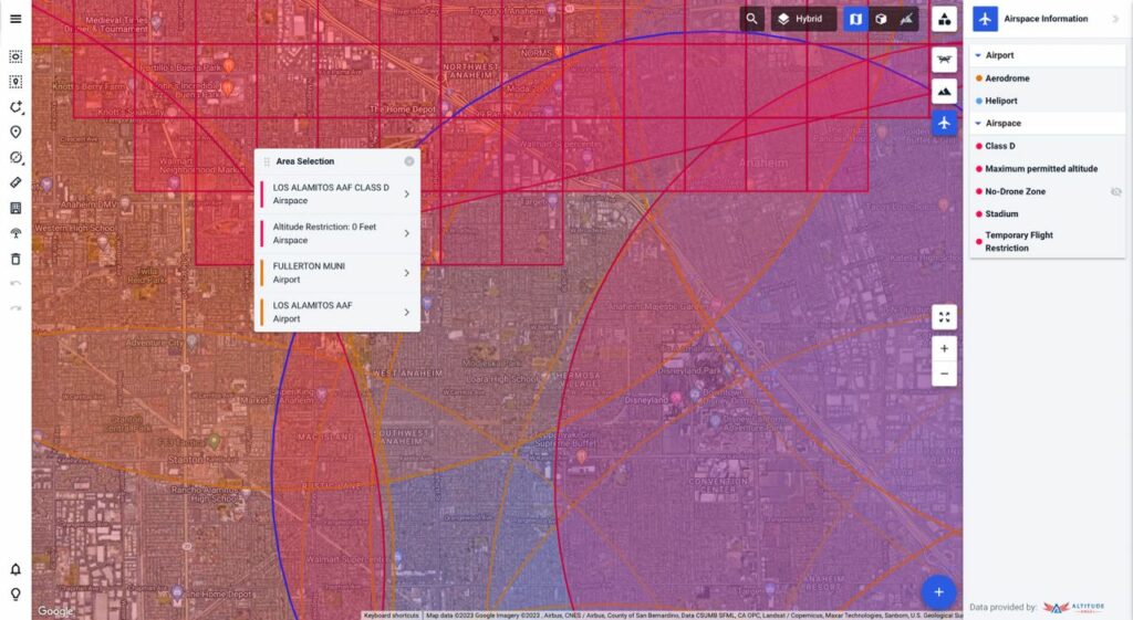
By hovering over specific layers in the airspace toolbar, the corresponding layer is highlighted on the map. In addition, by clicking on the map while the airspace layer is on, you can prompt a list of all airspace layers present in the corresponding area. Click on any item in the list for further details provided by Altitude Angel for the given airspace zone. To toggle the airspace layer off, simply click again on the airspace toolbar icon.
For additional information on Altitude Angel’s safety map visit Altitude Angel’s website.


