One of the most unique features of Drone Harmony Web is Hill Scan – an automated flight mission that allows you to inspect and map very complex and steep terrain. Hill Scan is a powerful and very flexible plan that is useful in various use cases including:
- When the terrain to be inspected is very steep (even vertical), e.g. when it represents cliffs, rock walls, steep hills, or even structures, such as dams.
- When the terrain profile is very non-uniform, e.g. hills, mountain peaks, canyons, and valleys, or combinations of flat and steep sections of a landscape.
- When it is important to direct the camera perpendicularly at the terrain surface.
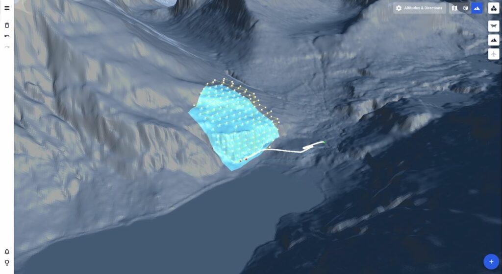
Planning a Hill Scan mission works like planning any other terrain-aware mission. You will require a terrain and at least one polygonal area in your scene to plan the mission for. The parameters to set are distance to surface (determining the Ground Sampling Distance), overlap parameters, and camera settings. All other attributes of the missions are set automatically by Hill Scan to achieve ideal results.
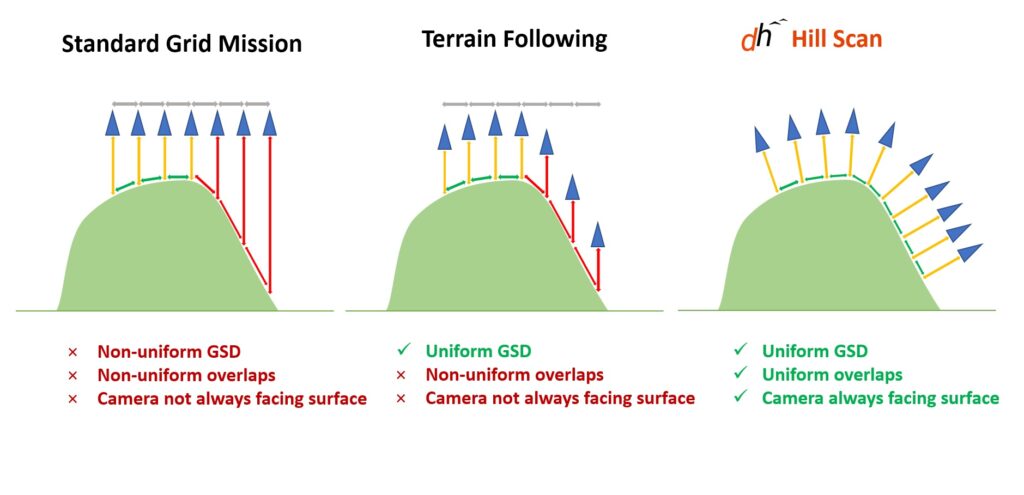
Hill Scan vs. Terrain Following
What is the difference between terrain following and Hill Scan? Traditional drone mapping surveys, including terrain following such as Terrain Map, rely on grid missions, which cover the area of interest with nadir images placed on a grid. The spacing between adjacent images is chosen to match an overlap parameter, and the flight altitude is selected according to the desired ground sampling distance (GSD – determines what area of the surface is represented by each pixel in the image). Compared to a standard grid mission, Terrain Following improves the acquisitions by adjusting the height of the flight to the local profile, which ensured a fixed GSD, but does not ensure overlap consistency, nor does it adjust camera angles to the terrain slope. Drone Harmony’s Hill Scan solves all these issues. The following figure gives a visual comparison between the three methods and summarizes their properties.
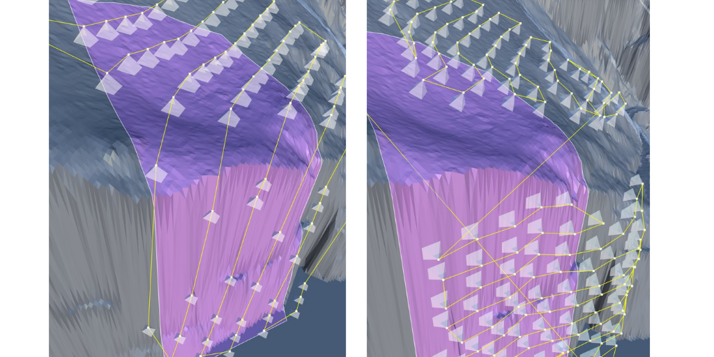
Left: Top Down, middle: Terrain Map, right: Hill Scan
Another valuable attribute of Hill Scan is its flexibility. One can use Hill Scan to map a larger area with varying elevation profiles, without the need to split the region into regions that are coherent in terms of slope or azimuth. As a result, hilly areas can be mapped in combination with flatter areas all in one contiguous mission. In summary, Hill Scan is a powerful tool that can assist in a variety of inspection activities, such as cliff stability assessment, mine site inspection, dam inspections, and more.


