For some time now, we have been working on a new, more user-friendly version of Drone Harmony Android Mobile that is based on the feedback from thousands of active users. Now we are ready to share our new app with you! In this article, we would like to introduce you to some of the key changes in the app to get you started faster and help you reap its many benefits.
New UI at the bottom of the screen for faster access to key features
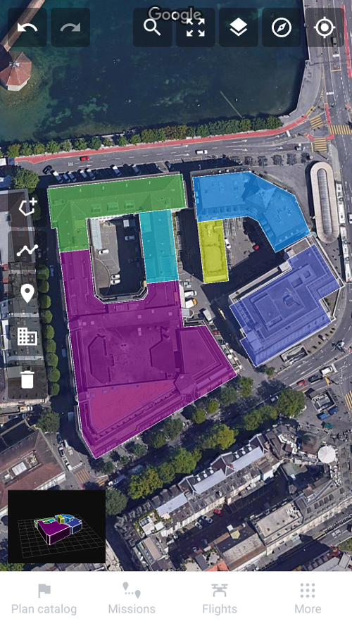
When you open the app, you’ll find most familiar tools at the top and left parts of the screen. The bottom panel, that is completely new, gives you quick access to the plan catalog, the missions you have created, the flights you have already flown, the site storage and the general settings.
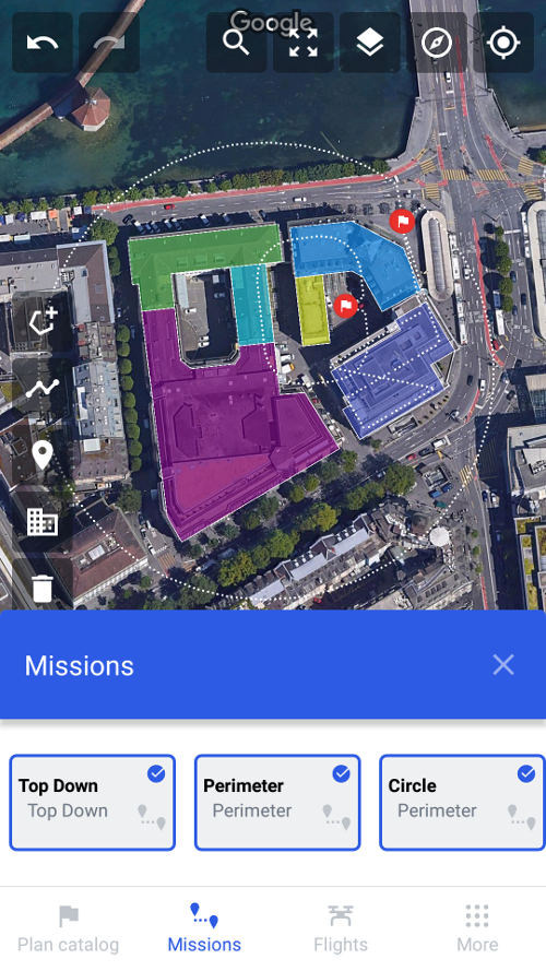
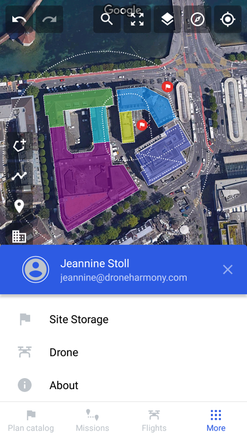
If you click on “Missions” at the bottom, you will see your created missions. You can select or deselect them. Click on “More” and you will find the site storage, information about the drone and your license. License information can be accessed by clicking on your name.
Editing tools are available at the top right
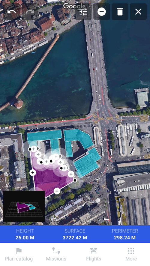
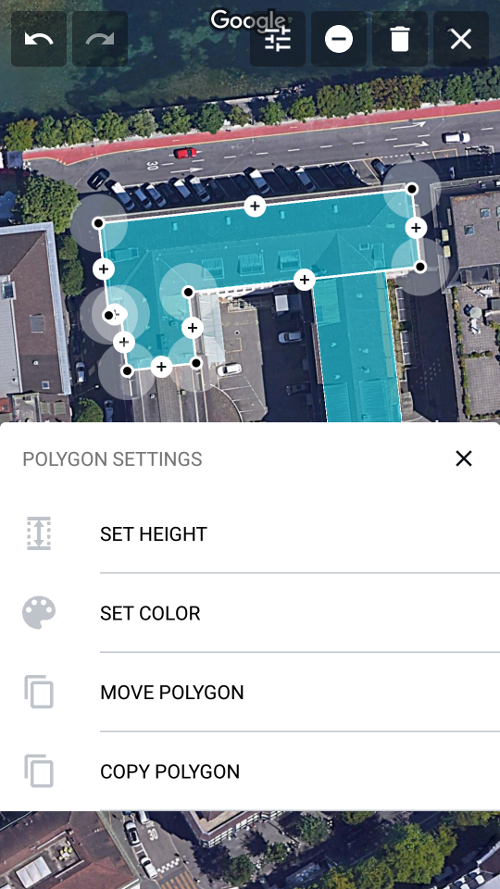
While you are creating a building, area, or line editing tools appear in the upper right corner. With these tools you can enter the height of a structure, choose the color, move or copy polygons, cut corners or delete your structures altogether. Click on the “x” to leave this menu. Apart from creating buildings yourself, you can still import the buildings with Open Street Map magic selection tool (left menu bar).
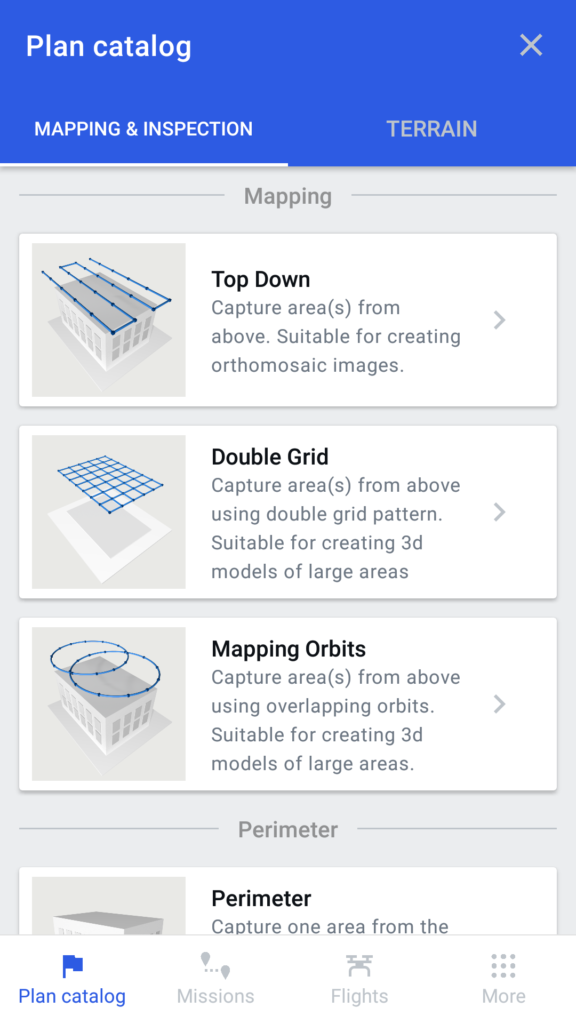
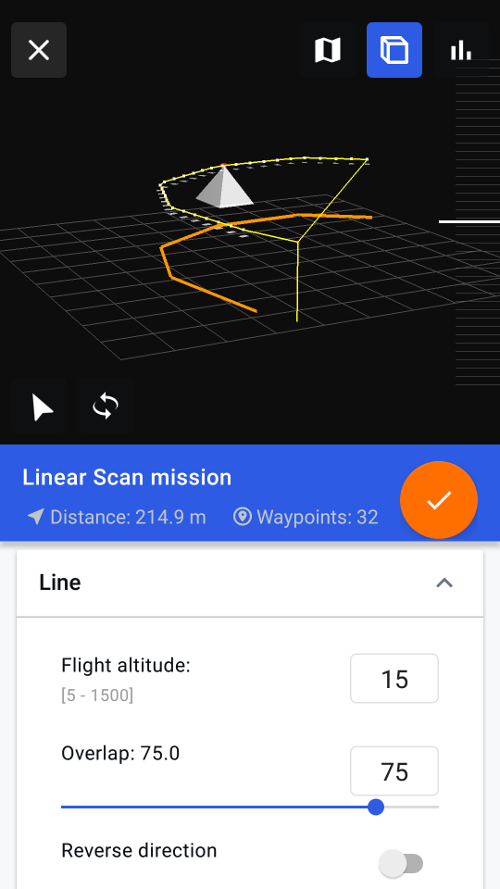
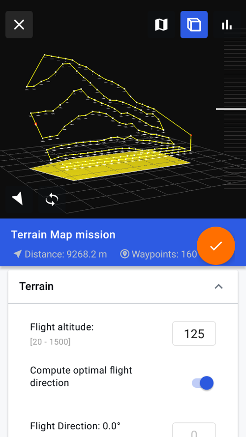
Improved mission planning UI
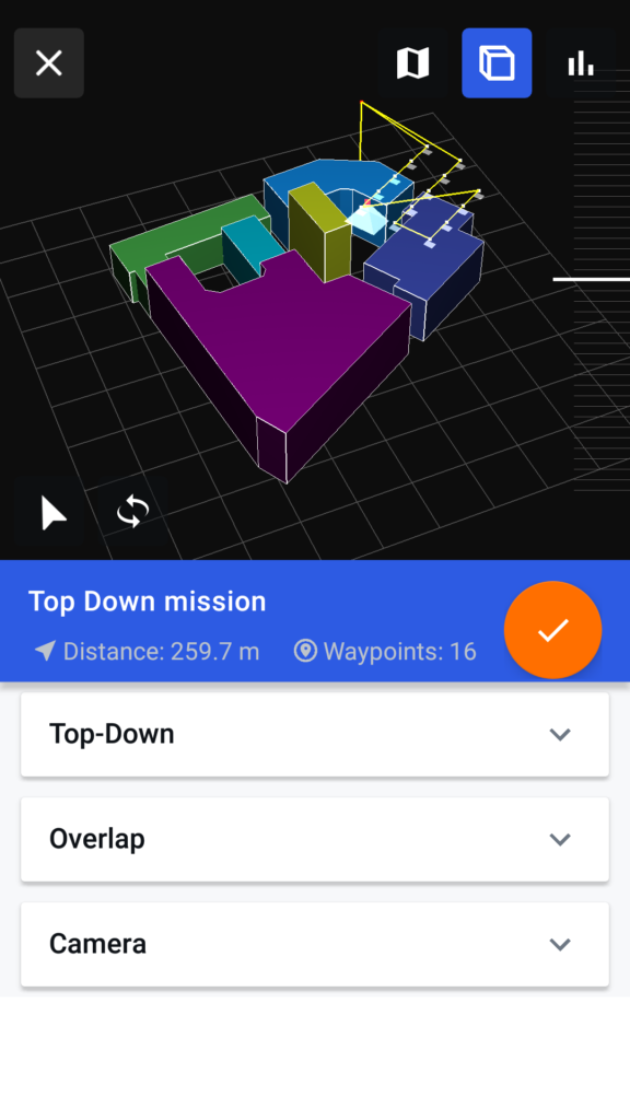
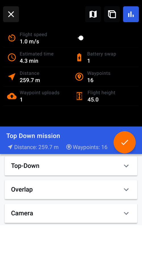
In the plan catalog, select the required mission and make adjustments if necessary in the respective dropdown menu. You can view the planned mission in 3d and 2d view or have a look at the mission statistics by toggling the viewing icons on the top right. With the scrollbar on the right side, you can simulate the mission in 3d. Click on the orange checkmark to complete the mission.
Create a line or an area (left menu bar) in order to create a Linear Scan or a Terrain Inspection.
Find further details in our blog post “New Drone Harmony Mobile App” and in this video.
Please do not hesitate to contact us if you have any questions. Email us at support@droneharmony.com


