We have just released a calibration feature that will allow you to calibrate the position of the drone and align it with the map with help of POIs.
This is how it works:
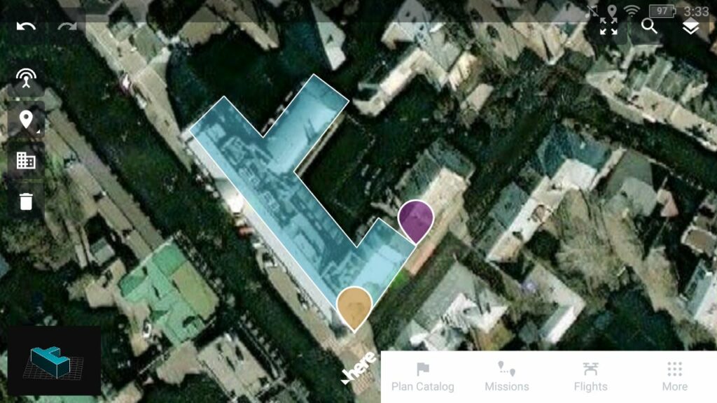
The relative positioning of elements on the map is correct, we need to reconcile the map with the drone position.
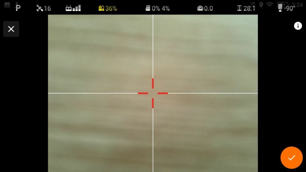
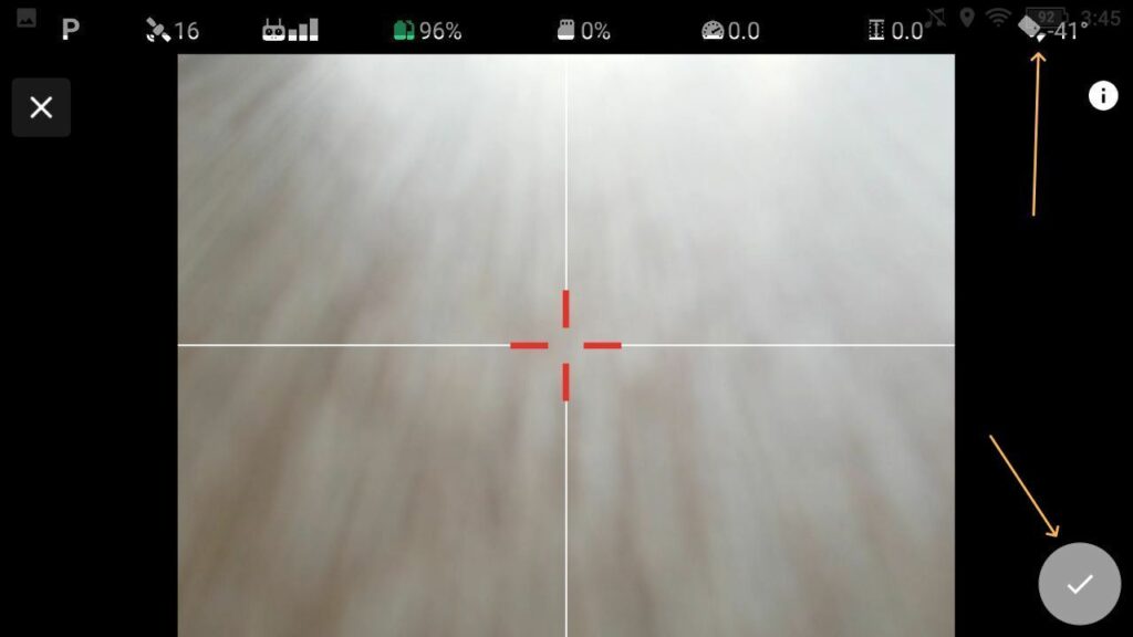
You should use a clear landmark (such as a well-visible corner of the building, etc.) to put a POI on the map.
The Point Of Interest will be used as an anchor point to bring the drone in alignment with the map.
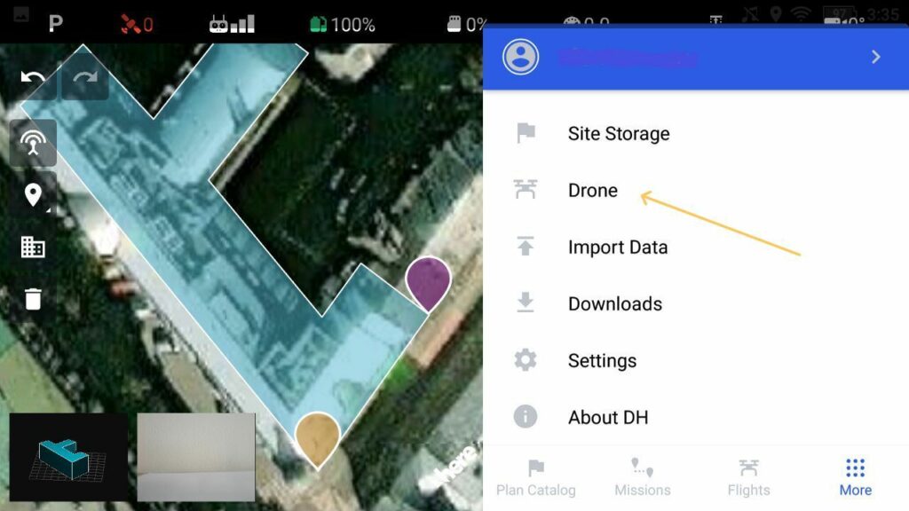
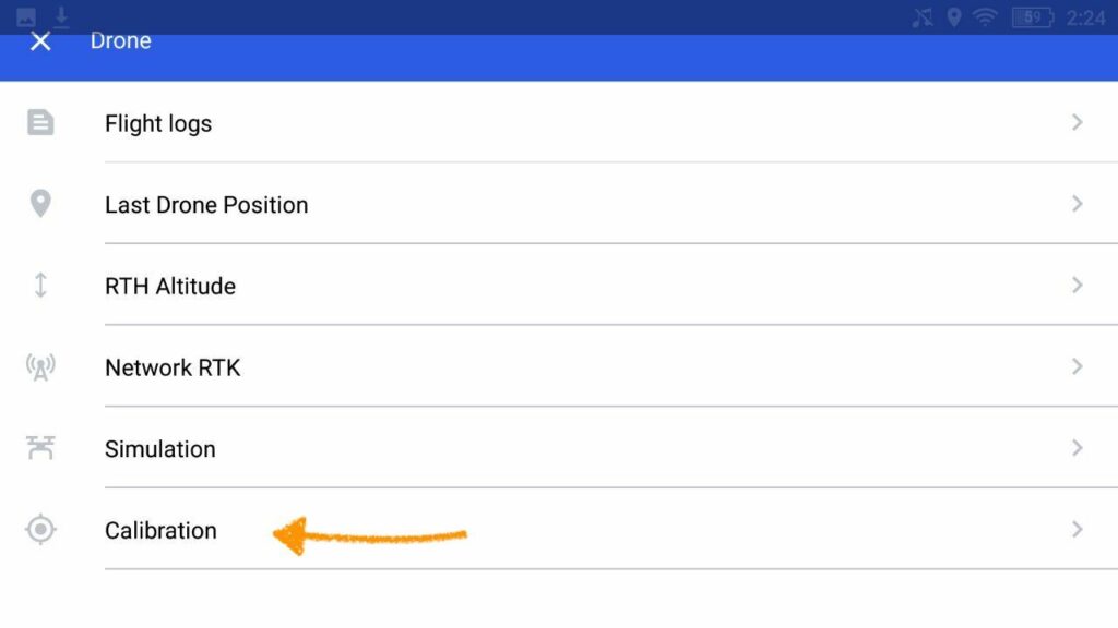
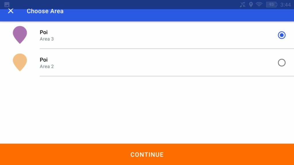
You will find this feature in a drone menu in your mobile app. Once you have clicked on calibration you will be able to choose a specific area with POI. Please see the attached below screenshots with step-by-step instructions.
As for now, it is available in manual mode only, but we are planning to release automated calibration soon.
For tower missions – the calibration will be initiated automatically.
While flying over the POI your gimbal should be set to -90 degrees, in other cases, the app will not allow you to confirm the position of the drone.
Once it’s done, calibration info would be visible in the telemetry bar.

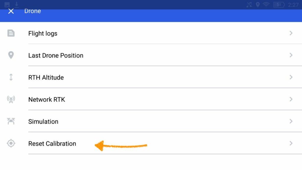
You can also reset the calibration in the Drone menu the same way you made it with the initial calibration.
Please be aware that it should be done on each battery swap, but if the drone has 2 batteries you can use hot swapping (for example m30).


